Picture of the month: Deciphering urban regions From the Institute for Sustainable Urbanism ISU
How do we get an indepth understanding of urbanisation patterns in a rapidly growing urban region? And how do we open up new approaches for a more sustainable development? In the international inter- and transdisciplinary research project “EAST-CITIES”, the Institute for Sustainable Urbanism (ISU) of the Technische Universität Braunschweig is evolving the TOPOI method, which is applied to enable the integrated analysis and description of settlement patterns along an urban-rural gradient in Qingdao in the eastern Chinese province of Shandong in our picture of the month.
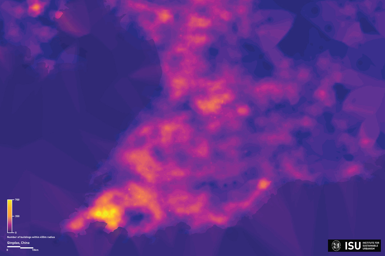
Areas in purple have a low proximity score and areas in yellow have a high proximity score. Picture credits: ISU/TU Braunschweig
The interdisciplinary EAST-CITIES team of Tongji University Shanghai, Technische Universität Braunschweig, GESIS Leibniz Institute for Social Sciences and partner institutions in Qingdao develop new approaches for integrated, data driven, scientifically validated, inter- and transdisciplinary founded sustainable development scenarios decoupling human development from negative environmental, social and economic impact. Researchers from the disciplines of architecture and urban planning, landscape and transport planning, engineering, economics and information sciences from China and Germany focus on the holistic development of “medium-sized” urban regions of up to 10 million inhabitants.
Gaining a better understanding of settlement patterns
The team of the Institute for Sustainable Urbanism (ISU) identifies and typifies existing and planned settlement patterns in Qingdao, China, on the basis of various attributes (e.g. density, functions, land use, accessibility, permeability, blue and green networks, proximity). In an iterative process, these TOPOI are enriched with findings of other disciplinary research, ultimately modeling and simulating the diverse interdependencies. Through the TOPOI method the scientists are able to gain a better understanding of settlement patterns along the urban-rural gradient. By evaluating these through a morphological approach it is possible to more accurately define and analyze dynamic urban-rural systems.
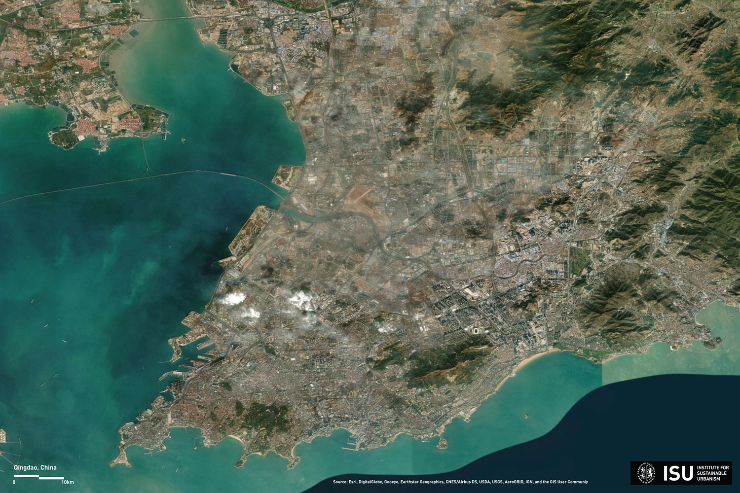
Satellite image of the Qingdao urban region in the eastern Chinese province of Shandong. Picture credits: ISU/TU Braunschweig, Source: Esri, DigitalGlobe, Geoeye, Earthstar Geographics, CNES/Airbus DS, USDA, USGS, AeroGRID, IGN, and the GIS User Community
The visualization gives insight into current EAST-CITIES research. ISU develops data-driven methods such as Image Classification to generate a comprehensive geospatial database based on satellite imagery and other accessible data sources. Based on this the scientists refine the TOPOI method initially developed within the METAPOLIS project. Model and data-driven multi-criteria geospatial analysis, advanced visualization techniques and visual analytic methods are applied to research on manifold attributes defining the Qingdao TOPOI, of which the map visualizes one: the proximity of buildings within a radius of 450 meters (5 minute walking distance) around each single building in the city.
Refining the TOPOI method
The ISU-team developed the map applying the Inverse Distance Weighted interpolation. IDW weighs the influence of one point to another relative to the distance between the points. This method allows to visualize building proximity and is one of a series of attributes describing the TOPOI to have a better understanding of the morphology and specifics of settlement patterns of Qingdao. Areas in purple have a low proximity score and areas in yellow have a high proximity score.