Move in the City Participatory experiments with the SpACE Lab at Digitaltag 2022
What makes a good urban space? What kind of streets and open spaces do we prefer? What helps us to find our way around the city? How should streets be designed to promote sustainable mobility such as walking and cycling in combination with public transport? That’s what the SpACE Lab at ISU – Institute for Sustainable Urbanism at Technische Universität Braunschweig wants to find out. At Digitaltag 2022, the team invites you to a virtual reality experiment in the Architecture pavilion that will take participants through Braunschweig. And they can become researchers and collectors of urban data themselves.
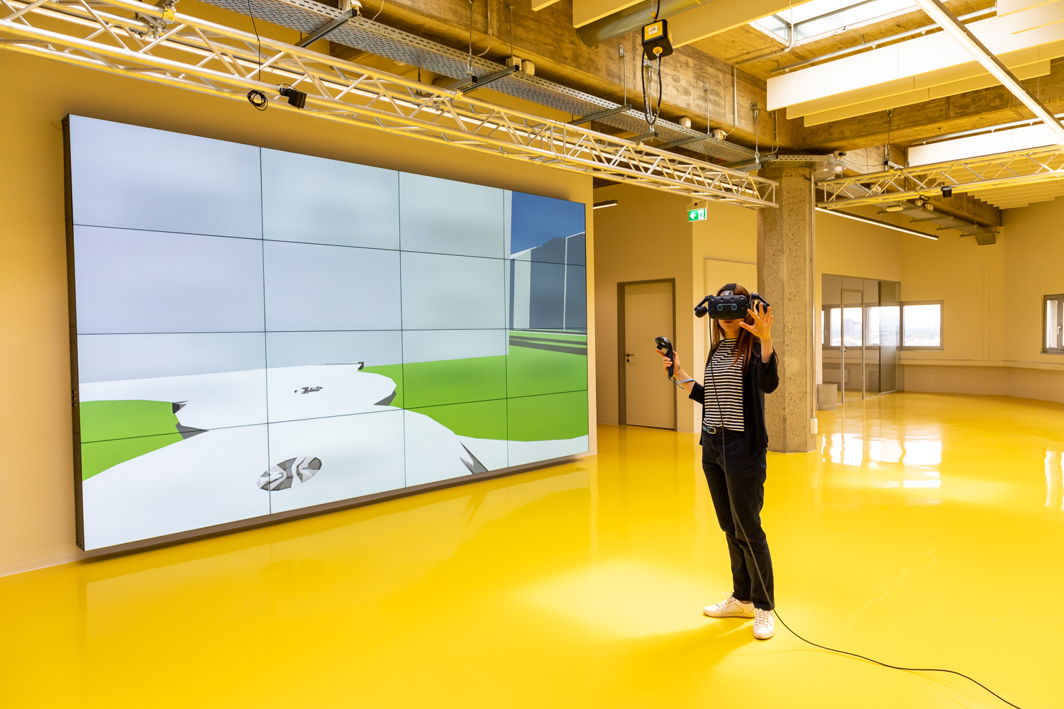
VR experiment: Which path do I choose? Photo credit: Kristina Rottig/TU Braunschweig
At the beginning of the virtual reality experiment is the decision: Which path do I take? Is one of the paths shorter? Which route do I know well or is my favourite? We start at the “Architower” on Mühlenpfordstraße in Braunschweig. The destination is Haus der Wissenschaft. Four routes are available to pedestrians: along the Hauptstraße (main street), via Katharinenstraße past university commons 1, towards the bakery and then on via Schleinitzstraße, or a tour along the Oker river.
On Digitaltag, the team wants to find out which route most of the participants in the experiment prefer. And they want to know why they choose this route. “The decision depends on the environment, but also on the person themselves,” says Dr Hsiao-Hui Chen, a researcher at the SpACE Lab. “The choice would certainly also be different again if we set a time limit for the route or if the path had to be walked in the dark.” In the VR project “Move (in) the City – Participatory Spatial Virtuality”, participants can explore how their own movement in the city is influenced by the structure and design of physical space.
Feedback for administrations and planners
In the SpACE Lab, scientists are developing new technology-based methods to collect user-centred data. The goal is a better understanding of individual decisions, preferences and behaviours in the built environment. The advantage of virtual reality is obvious: the complex relationships and interactions between the environment and pedestrians can be systematically studied and quantified in a controlled environment. At the same time, the researchers can change the street design again and again and thus analyse the behaviour in very different street configurations and cities. “The feedback and perspective of the users can then be integrated into the decision-making process of administrations, planners and architects, for example, in order to contribute to human-centred, knowledge-based planning and design of sustainable cities and urban regions,” explains Olaf Mumm, deputy director of the Institute for Sustainable Urbanism (ISU).
The experiment is additionally made available for download as open source. This allows interested people to perform the same experiment on their own devices, share the data and their experiences with the SpACE Lab.
Sense your city

The sensor kits for urban data collection are being prepared. Photo credit: SpACE Lab/TU Braunschweig
At the same time, the SpACE Lab’s workshop “Sense your city – Participatory Urban Data Lab” provides knowledge about the use of small sensor kits to collect urban data such as noise, temperature and humidity in streets. “This technology makes it possible to collect data in a simple way and to involve citizens in the sense of citizen science,” says Dr Deepank, whose research at the SpACE Lab focuses on data-driven methods for analysing and evaluating urban and mobility spaces.
The device consists of an LCD screen, an orientation sensor, a built-in battery, a microphone, WLAN and Bluetooth connectivity and an extendable base for attaching further sensors. In groups, the participants at Digitaltag develop possible use cases to collect and evaluate data, for example on street noise, vegetation or buildings. Together, they will create the necessary sensor kits. They can then install the devices in the urban space, visualise the data collection in real time and evaluate it together.
“Among other things, data-driven analyses can help to gain a better understanding of mobility spaces, their barriers and obstacles for the design of sustainable mobility and accessibility for all population groups,” says Prof. Dr. Vanessa Miriam Carlow. “They can also be used, for example, to check one’s own living or working environment for noise emissions and thus gather information for urban development, for example in the context of noise reduction planning.”
SpACE Lab
The SpACE Lab – Spatial Analytics and Crossdisciplinary Experimentation Lab at the Institute for Sustainable Urbanism (ISU), led by Professor Vanessa Miriam Carlow, is a centre of excellence for multidisciplinary urban research that combines architecture, urban design and planning with a variety of other disciplines. With its research, the team aims to promote human-centred, knowledge-based planning and design of sustainable cities and urban regions. It is a founding member of the Leibniz WissenschaftsCampus Postdigitale Partizipation Braunschweig and develops new methods that enable citizens to participate in the design and planning of the city.