Tsunami in the Wave Flume Flood wave experiments for resilient structures
What exactly happens during a tsunami? What effects does the flood wave have on homes, warehouses and bridges? How reliable are buildings once piers and walls have been flooded by water masses? To find out more about this, an international team of scientists from the TU Braunschweig, Leibniz Universität Hannover and the University of Ottawa in Canada generated tsunami-like waves in the Large Wave Flume of the Forschungszentrum Küste (FZK).
A tsunami wave rolling through the wave channel. Picture credits: Gideon Rothmann/TU Braunschweig
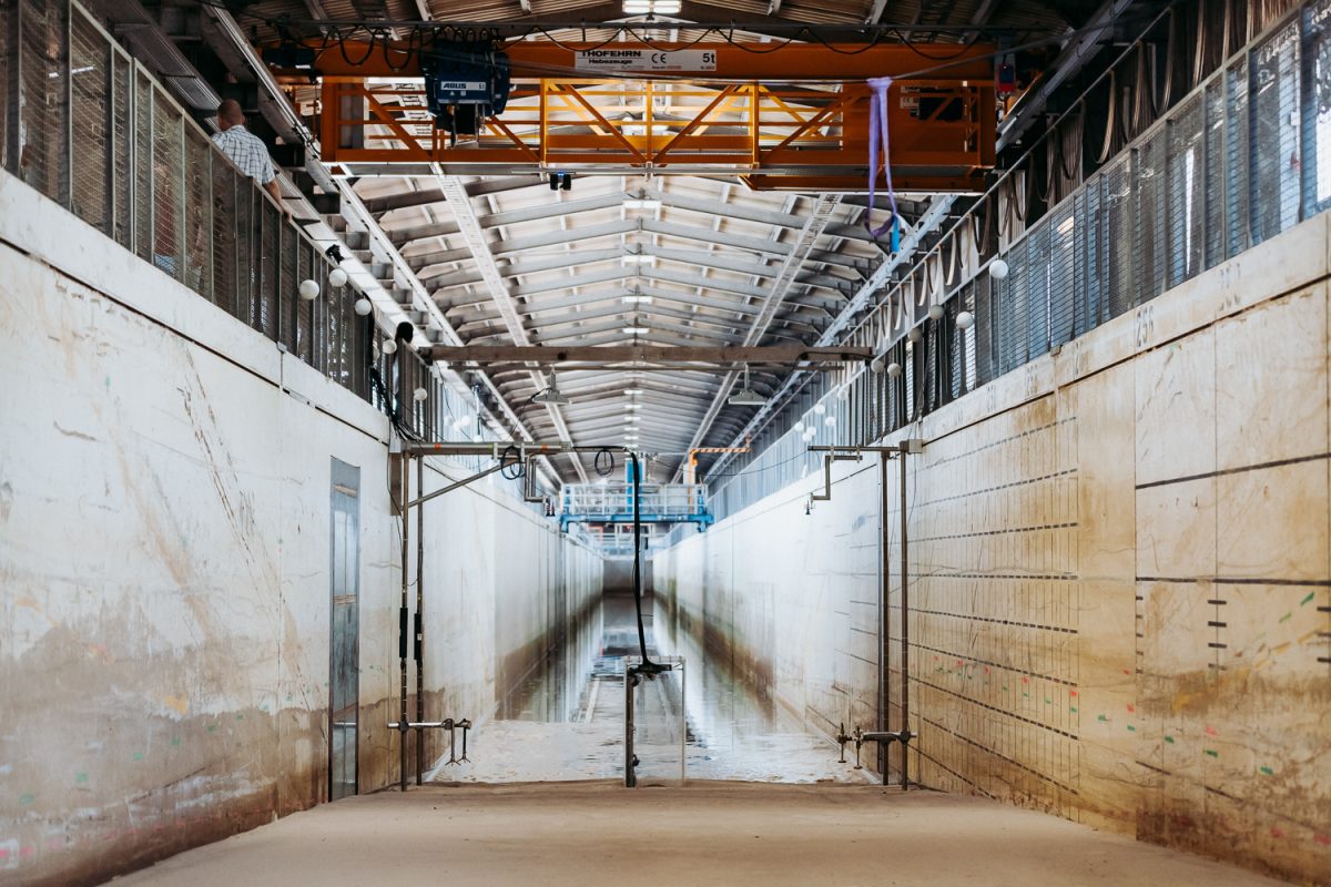
This much in advance: anyone expecting waves as high as a house during the experiments will be disappointed. The tsunami waves in the Large Wave Flume (GWK) in Hannover are no more than 1.10 metres high. “This is of course a laboratory scale, we would hardly get the natural scale approved,” says Clemens Krautwald, scientific assistant at the Leichtweiß Institute for Hydraulic Engineering and Water Resources (LWI), with a wink. Nevertheless, the force of such a tsunami on a scale of 1:5 can be estimated when looking at the GWK.
Stability of structures at risk
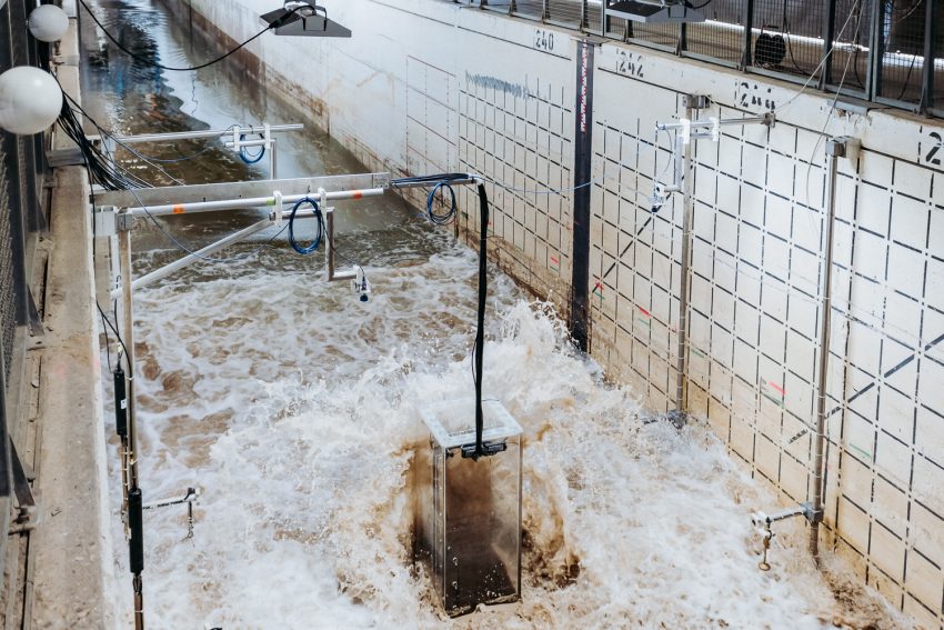
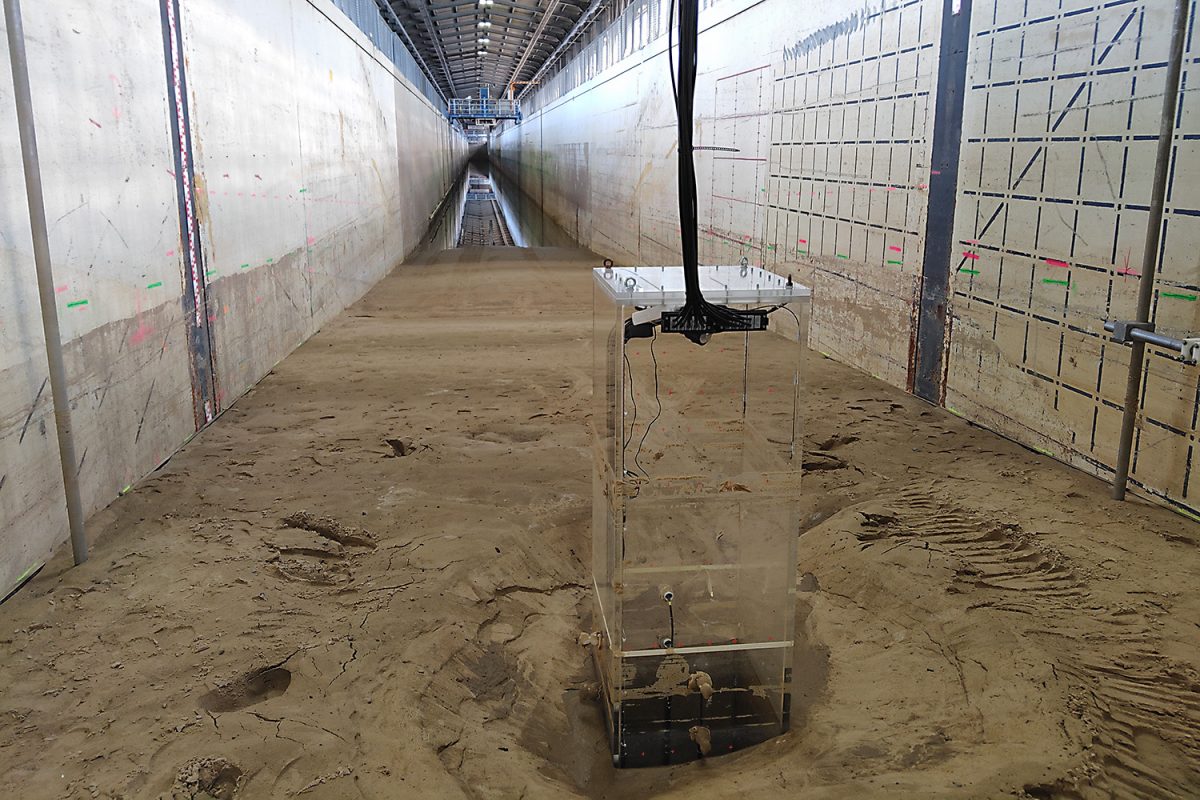
The flood wave hits a plexiglass pillar with full force, causing water to splash upwards, washing around the pillar and dragging sand back into the canal. The support built into the ground simulates a bridge pier, which here has a base area of 60 by 60 centimetres, in nature this corresponds to around three by three metres. The aim of the experiments is to precisely record the scour formation caused by a tsunami around a structure, i.e. the formation of local soil leaching. The scientists want to know what happens around this pillar. Stronger turbulence is created around the Plexiglas pillar and sediment is released. The pillar is no longer firmly anchored in the ground. In tsunami areas, such as Indonesia, the Mediterranean or North America, the stability of buildings could be endangered after such a flood wave.
So far, everything is calm in the wave flume. Picture credits: Gideon Rothmann/TU Braunschweig
The Large Wave Flume is being prepared for the tsunami-like waves. Picture credits: Gideon Rothmann/TU Braunschweig
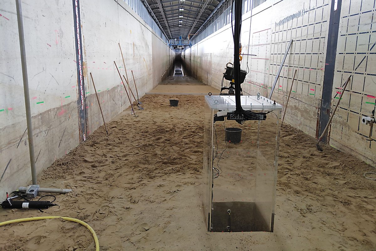
The plexiglass support installed in the sand simulates a bridge pier. Picture credits: Gideon Rothmann/TU Braunschweig
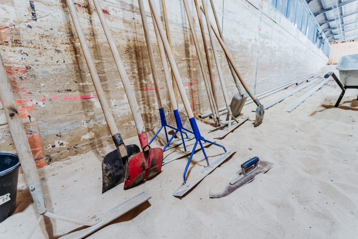
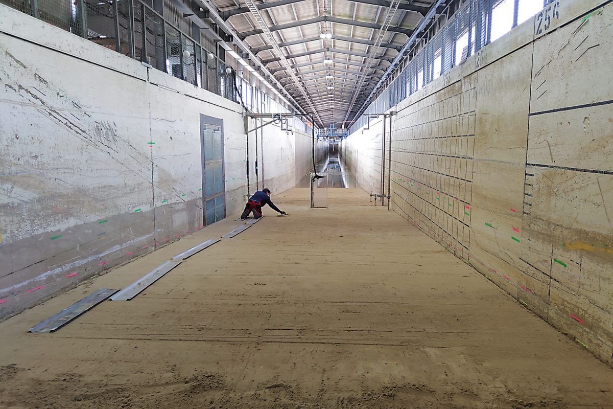
The important tools for profiling the sand in the canal. Picture credits: Gideon Rothmann/TU Braunschweig
Shovelling and smoothing: The first step is to profile the 1,600 cubic metres of sand in the canal. Picture credits: LWI/TU Braunschweig
Short break. Picture credits: LWI/TU Braunschweig
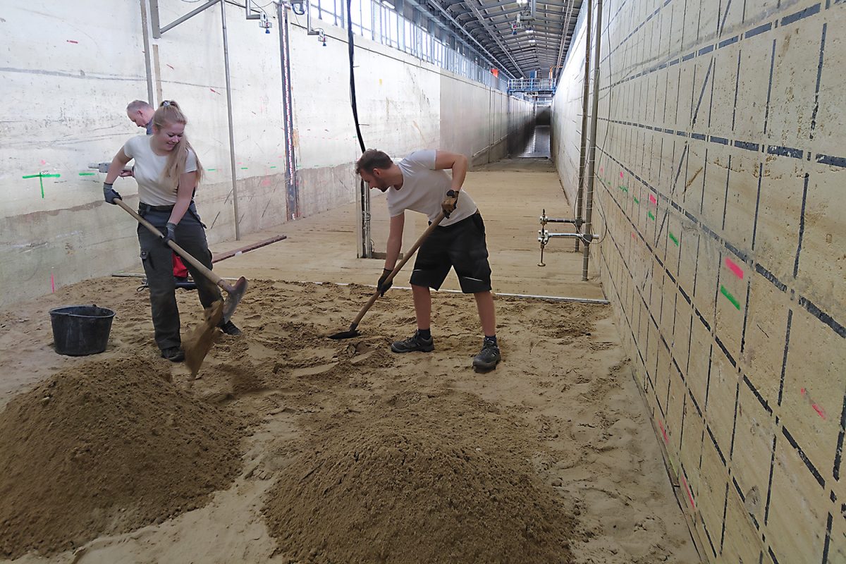
After each day of experiments, the team had to smooth out the entire 60-metre long beach section. Picture credits: LWI/TU Braunschweig
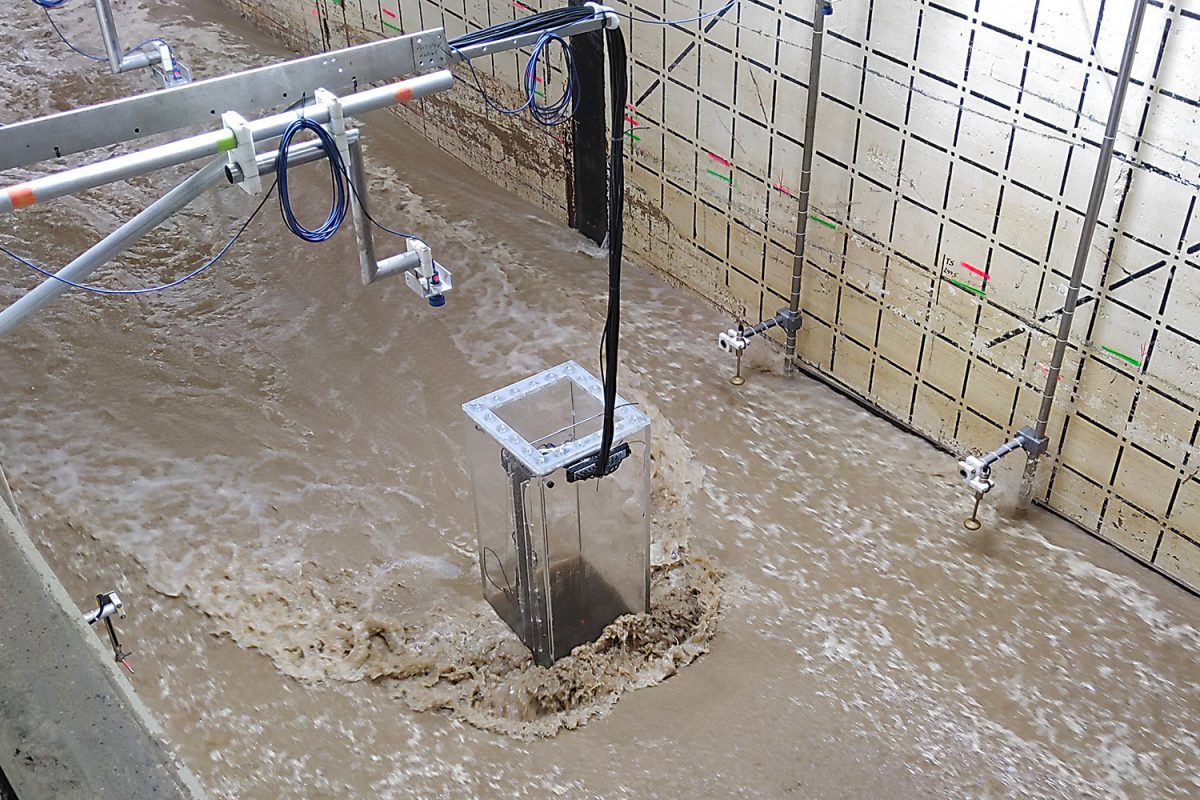
The soil around the bridge pier has eroded. Picture credits: LWI/TU Braunschweig
Looking good! Picture credits: LWI/TU Braunschweig
Please clean up again! Picture credits: LWI/TU Braunschweig
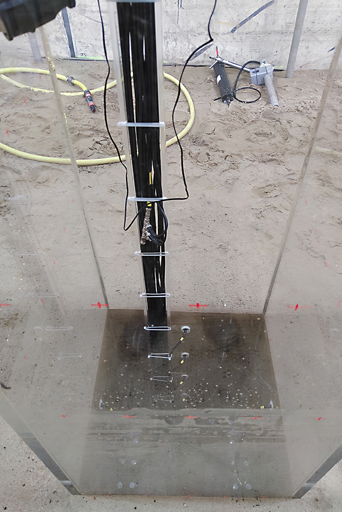
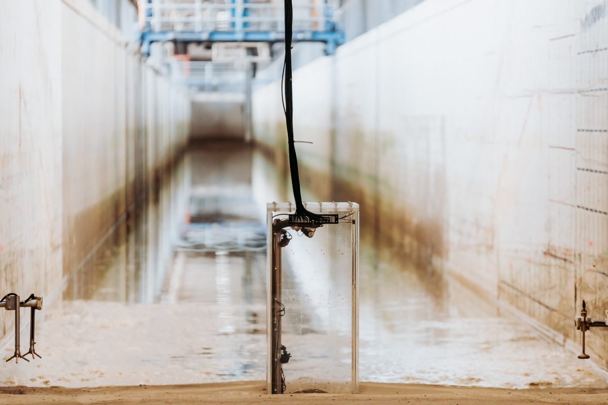
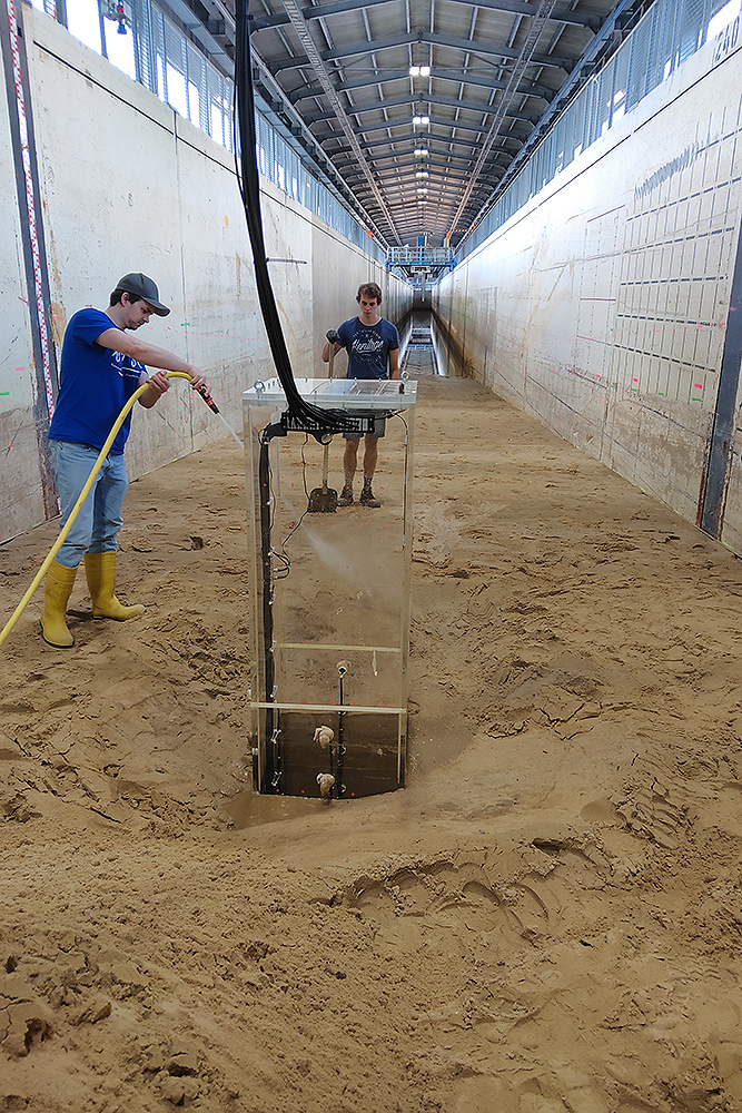
The pillar is made of Plexiglas so that the researchers can see through the water column during the experiment. They installed four small cameras on the inside. Picture credits: LWI/TU Braunschweig
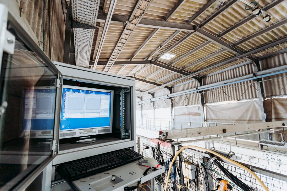
The progression of the water level, the height, period and speed of the wave as well as the flow depths around the structure are measured. Picture credits: Gideon Rothmann/TU Braunschweig
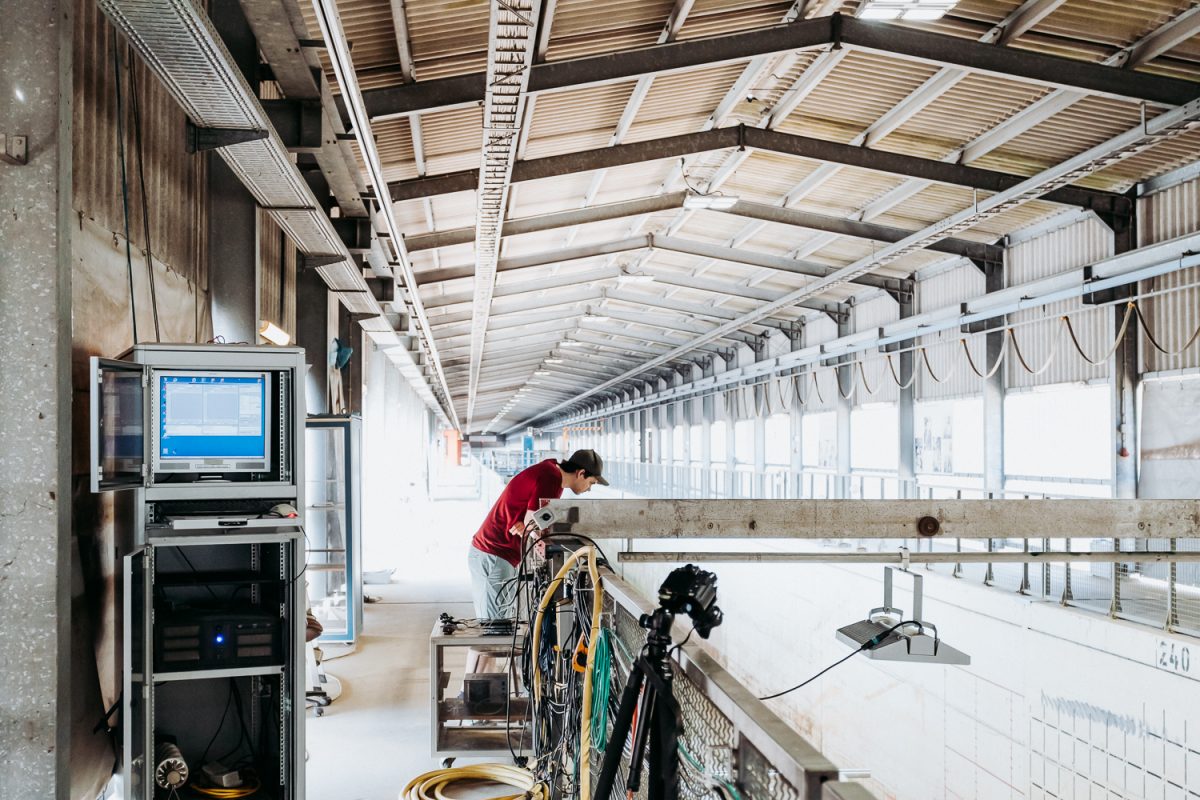
One last critical look from Alexander Schendel of the Ludwig-Franzius-Institut für Wasserbau, Ästuar- und Küsteningenieurwesen of Leibniz Universität Hannover. Picture credits: Gideon Rothmann/TU Braunschweig
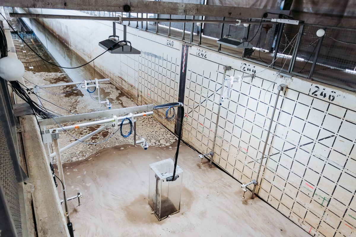
Instruments and cameras are installed around the pier. Picture credits: Gideon Rothmann/TU Braunschweig
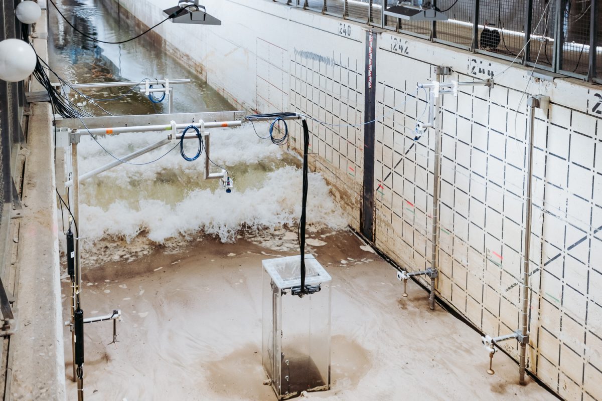
The flood wave is rolling in. Picture credits: Gideon Rothmann/TU Braunschweig
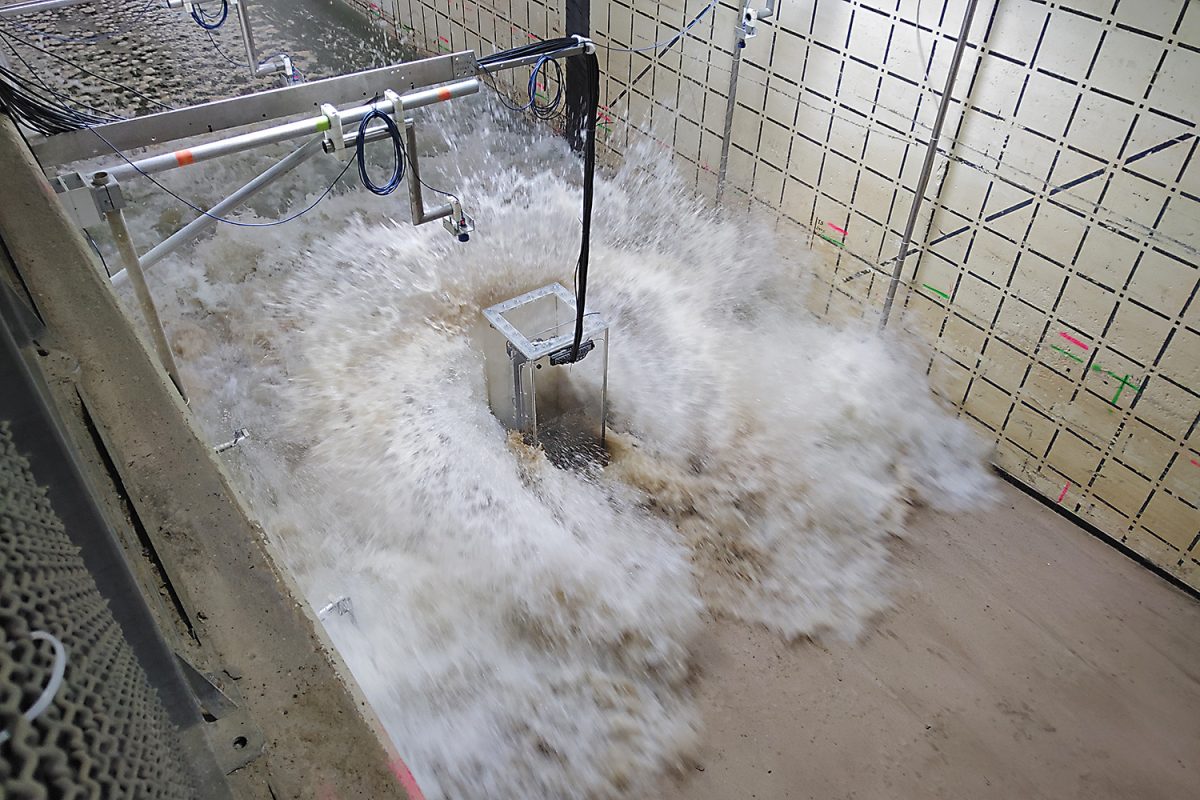
The approaching flood wave hits the plexiglass pillar with full force. Picture credits: LWI/TU Braunschweig
During drawback, the wave drags along sand in the flume. Picture credits: LWI/TU Braunschweig
For structural stability it is important to know the maximum scour depth. The scour depth is the erosion near a construction element. But then what is the maximum scour depth? Clemens Krautwald explains this very vividly: “A wave washes over my feet on the beach. When the wave is gone, I see that some sand remains on my feet, and my feet have sunk in a little. The thing I can see and measure is the depth of the end scour. What I felt during the process is the maximum scour depth.”
The maximum scour depth can not be measured after a tsunami. The calculation formulas are therefore mainly based on field studies after a tsunami. This is effectively too late for a precise understanding of the process that is important for structural stability. “That is why it is unique and a huge opportunity that we were able to carry out these large-scale experiments on our Large Wave Flume,” says Clemens Krautwald happily.
A beach in the wave channel
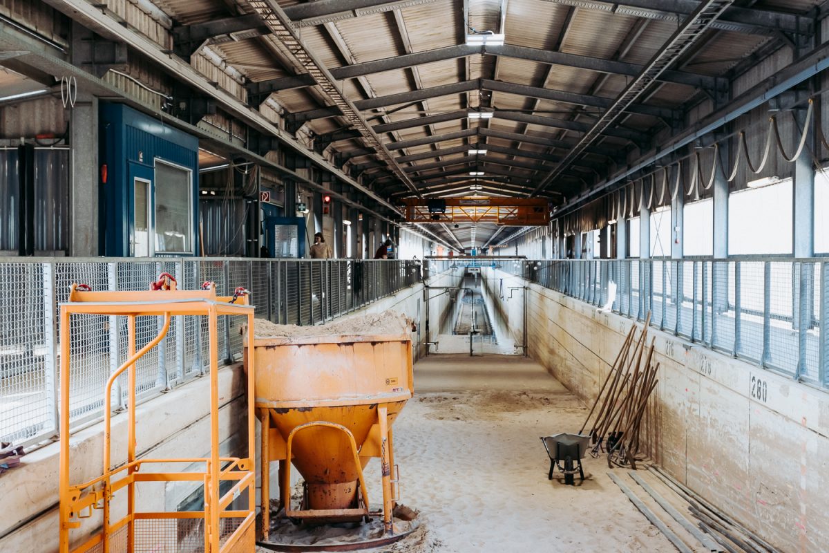
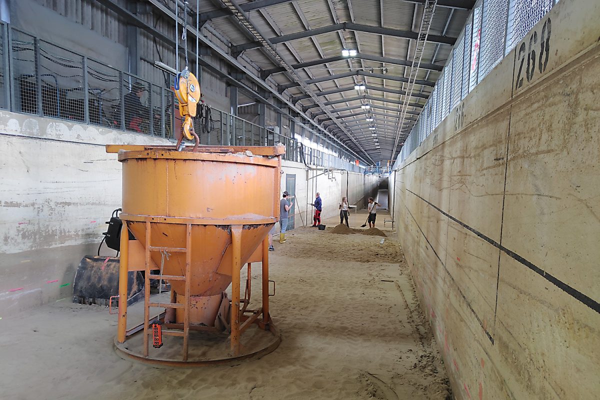
The research team had planned nine test days spread over four weeks for its experiments. But before the first wave could flow through the canal, the scientists first had to profile the 1,600 cubic metres of sand in the canal – around 30 cubic metres of sand had to be moved. Not everything was done with muscle power alone, smaller machines and grabs were also used. After each test day, the team had to smooth out the entire 60-metre long beach section again.
Before, the scour was photographed and the erosion profile was measured with a 3D laser scanner. To allow for a comparison of the model sunami with reality, the course of the water level, the height, period and speed of the wave as well as the flow depths around the structure were measured during the tests. “Only if we link all the recorded data meaningfully and logically will we be able to understand the underlying processes and make recommendations for action,” says Professor Nils Goseberg, head of the Division of Hydromechanics, Coastal and Ocean Engineering at LWI.
The pillar is made of Plexiglas so that the researchers can see through the water column during the experiment. They have installed four small cameras on the inside, which among other things recorded the temporal course of the scour depth. Using pressure sensors directly on the pillar below the ground, the scientists want to draw conclusions as to whether the ground is still stable.
This is relevant, for example, for bridges used as escape routes during a tsunami. The bridge piers must be anchored deep enough in the ground to withstand the stress of the water. This is what the scientists are trying to find out with their experiments. At the moment, the maximum depth of the degradation scour is 3.60 metres. “We assume that this may not be enough,” says Clemens Krautwald.
After the experiment is before the experiment
A similar study was last conducted some 20 years ago, he reports. The current American construction guidelines of the American Society of Civil Engineering (ASCE), which are considered worldwide to be the standard for the design of tsunami-proof structures, are therefore based primarily on observations.
Following the series of experiments in the Large Wave Flume, which is now being converted for the extension to the GWKplus, further experiments are planned in the LWI experimental hall. In order to be able to compare the effects, the team will use the exact same sediment in the 1- and 2-meter channel. Only the waves will be slightly smaller.
Videos: LWI/TU Brunswick