#flut23: Search for photos and videos of the Christmas floods TU Braunschweig wants to improve flood protection
Flooded roads and paths, softened dikes, sandbag barriers – many parts of Lower Saxony were under water at the turn of the year. Days of rain had caused rivers to swell, leading to flooding. And now the water levels are rising again, increasing the risk of flooding. Researchers at Technische Universität Braunschweig are working to improve flood forecasting. The Leichtweiß-Institute for Hydraulic Engineering and Water Resources is asking people to send in photos, videos and drone footage of the “Christmas flood” in the Aller-Leine-Oker region.
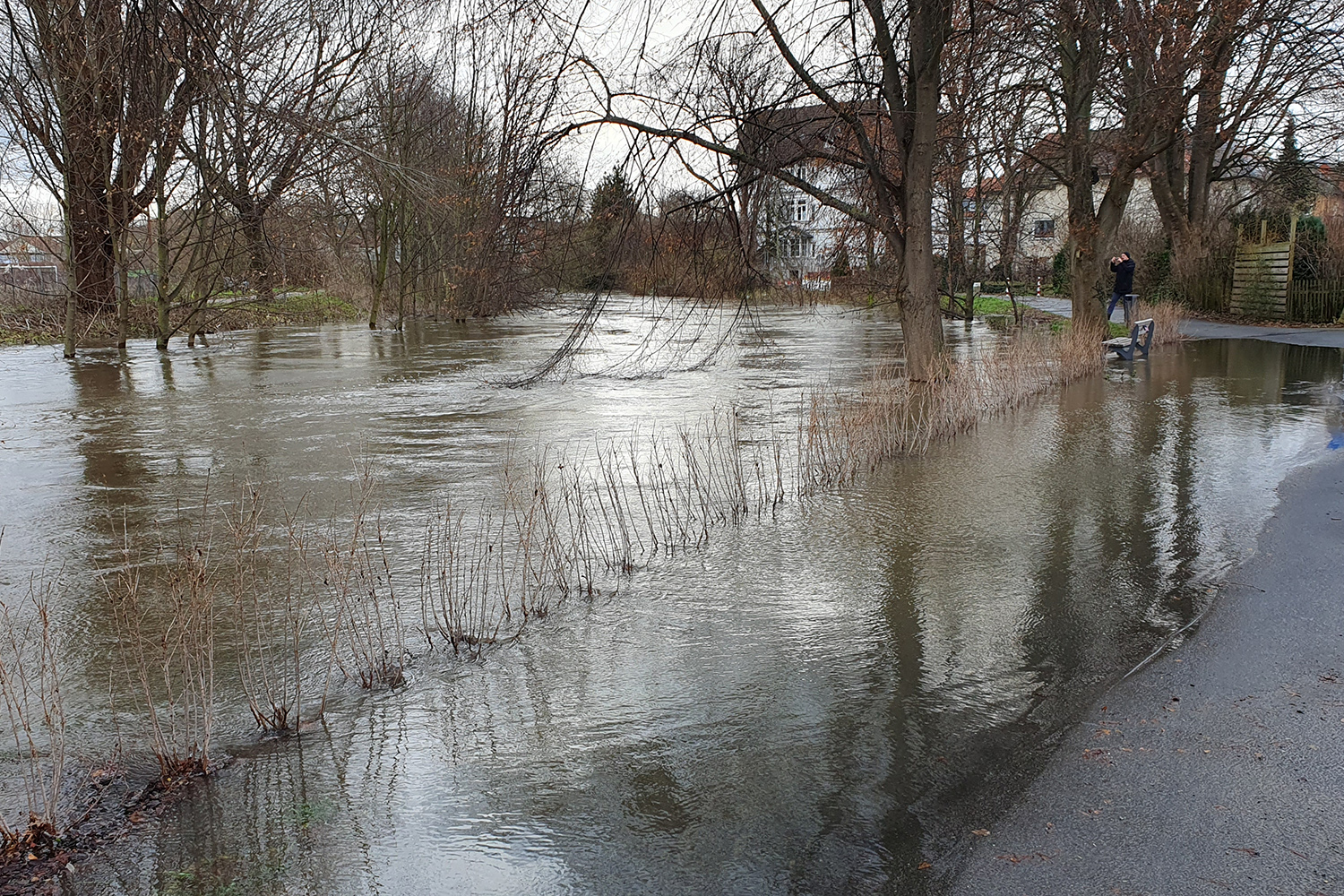
View from the Okerbrücke bridge at Friedrich-Ludwig-Jahn-Platz in Braunschweig on 25 December 2023. Photo credit: André Wisniewski
“Using the images, we can infer the water levels at the respective times or estimate the amount of water accumulating on fields, for example, and compare them with the results of our ‘Panta Rhei’ rainfall-runoff model,” explains Dr. Hannes Müller-Thomy from the Department of Hydrology and River Basin Management at the Leichtweiß Institute of Hydraulic Engineering and Water Resources (LWI). “These comparisons allow us to systematically improve our model, which is also used for flood forecasting. The observations submitted can thus contribute to the protection of each individual.
A lot of observational data needed
Especially in the case of rare extreme flood events, it is important to compare and improve the calculated results with the actual water levels and floods at as many locations as possible. However, these comparisons are only possible if a large amount of observational data on river levels is available. Although some river water levels are available, more information is needed to make comprehensive statements.
The analysis and management of flood risks and the development of flood runoff forecasting models for early warning are a research focus of the Hydrology and River Basin Management Department at LWI. Current research projects, such as the EU-funded DIRECTED project, are developing methods for integrating data into simulation models and tools for the secure exchange of information for the management of floods and other natural hazards.
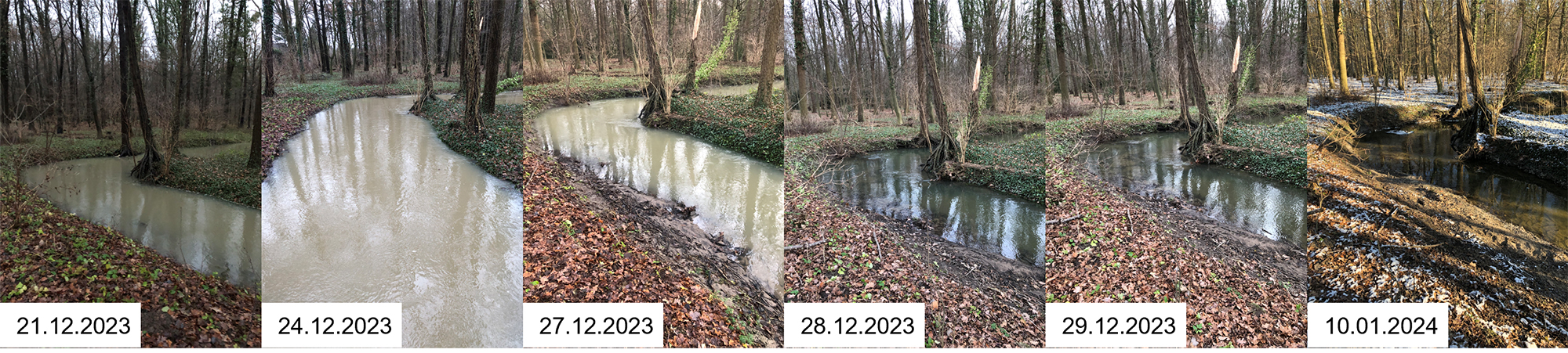
Flood course of the Haster stream, Haste. Photo credit: Michael Kirschner
Submit photos and videos
The researchers are asking for photos and videos of rivers and flooded areas to be sent to hydriv-public@tu-braunschweig.de or via the cloud of TU Braunschweig at https://cloud.tu-braunschweig.de/s/6LSSWSYdLpG564m.
On social media, photos can be tagged with the hashtag #flut23 so that researchers can filter and use them in a targeted way.
It is important for all submissions to state the location (e.g. street name) and the date and time the photo was taken. It is easier to find the location if several features of the location are mentioned, e.g. body of water, town, street name/intersection.
Pictures taken from the same location during and after the flood are particularly valuable for assessing differences in water levels.