How Europe’s Mega-Floods Are Becoming Predictable Professor Kai Schröter on flood prevention
Flood disasters like the one in the Ahr valley in 2021 continue to take people and authorities by surprise – with sometimes devastating consequences. But how can such extreme floods be better predicted? A research project led by the TU Wien shows that international data from hydrologically similar areas can provide important information for forecasting. Professor Kai Schröter from the Leichtweiß-Institute for Hydraulic Engineering and Water Resources at TU Braunschweig, who was involved in the study recently published in Nature Geoscience, gives an insight into the project and the challenges for better flood prevention.

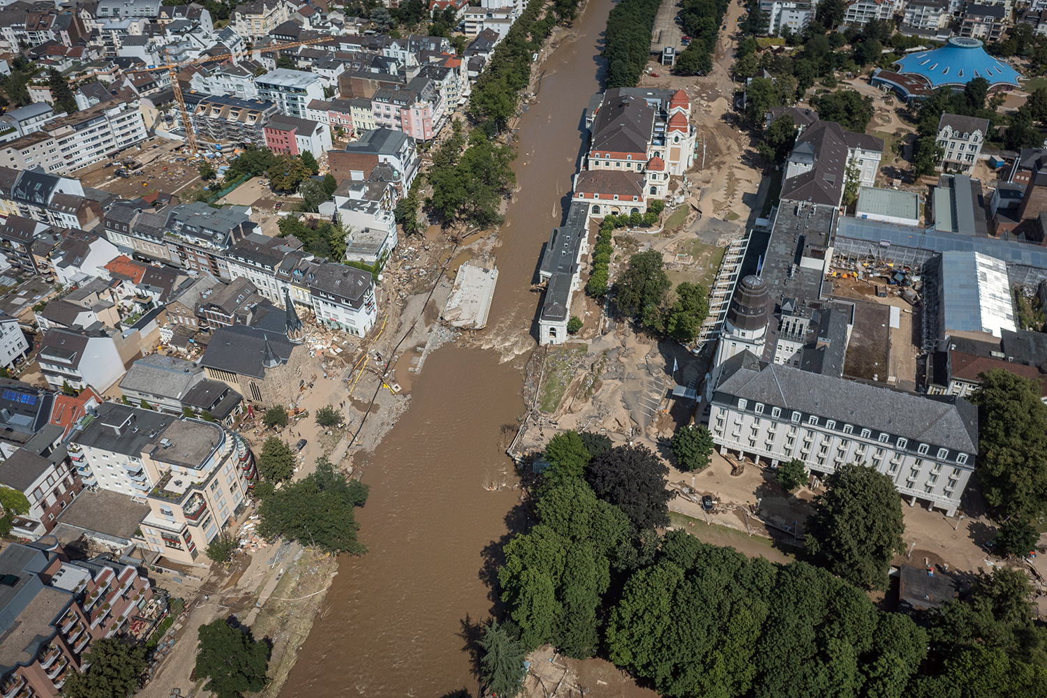
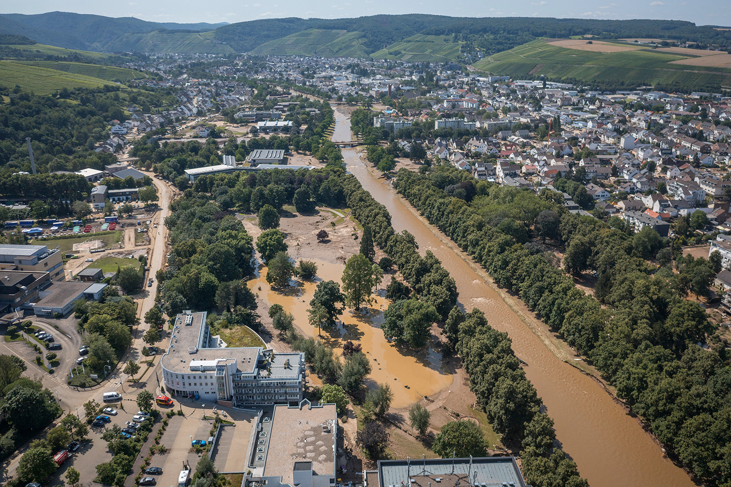
The town of Bad Neuenahr-Ahrweiler in the Ahr valley after the flood of 2021. Photo credit: District administration of Ahrweiler/ Bernhard Risse
Extreme floods are difficult to predict due to their rarity and the lack of sufficient observational data. Looking at the history of local floods is often not enough to know what to expect in the worst-case scenario. The result is inadequate flood defences against so-called “mega-floods”, which far exceed previous records.
But when you look beyond the local data to the entire European continent, these seemingly unexpected events are no longer so surprising. “Until now, floods have mainly been assessed in a local context. However, if you broaden your perspective, you can learn a lot, for example about the particular development processes of extreme events,” says Professor Kai Schröter, Head of the Department of Hydrology and River Basin Management at the Leichtweiß-Institute for Hydraulic Engineering and Water Resources (LWI).
Europe-wide data analysed from 1810 to 2021
In a major research project led by the TU Wien, researchers analysed data from more than 8,000 water level stations across Europe – from the years 1810 to 2021. The researchers divided Europe into flood-climatic regions and examined comparable events to identify patterns and correlations. They found that areas with similar hydrological characteristics can experience very similar extremes across the continent. In other words, the magnitude of recent major floods could have been predicted based on previous events elsewhere in Europe.
When looking beyond the local horizon, it is important to consider not only geographically neighbouring regions, but also areas with similar conditions. For Germany, for example, depending on the location, this could be the Atlantic region with Great Britain, the Netherlands and north-west France, or the continental region. The size of the catchment areas and, in particular, similar hydrogeological, topographical, land-use and climatic conditions can be used as a guide. For the Ahr valley, for example, there are comparable regions in Slovenia. “Here we can draw conclusions about the expected extent of a flood from the observed data,” says Professor Schröter.

How can mega-floods like the one in the Ahr valley in 2021 be better predicted? Here is a view of Bad Neuenahr-Ahrweiler after the flood. Photo credit: District administration of Ahrweiler/ Bernhard Risse
The evolution of mega-floods
So a flood like the one in the Ahr valley was predictable? “Predictable in the sense that one could expect that such an event could occur, but not necessarily when,” explains Professor Schröter. “The results of the study underline the fundamental importance of data from systematic observation networks for a better understanding of natural events at local, regional and continental scales. The study not only provides insights into the development of mega-floods, but also highlights the need to proactively prepare for such extreme events and to improve the transfer of flood risk management knowledge between regions, including internationally”.
At this point, Professor Schröter feels it is important to recall the dimensions of a “mega-flood”. The researcher draws a comparison with the flood in Lower Saxony, which has just receded: “In terms of peak discharge, this flood is significantly lower than what we classify as a mega-flood in our study”.
To improve flood prevention, the data from the study should be incorporated into simulation models for flood risk management and communication and data exchange should be strengthened, says Schröter. “So that it is available and can be accessed by the various stakeholders at the right time,” he stresses. “Due to the complex federal and municipal competences and responsibilities, it is not always clear who needs to know what and when. There are different responsibilities for different water bodies, but these usually do not stop at national borders. There is also a lack of data compatibility: “For our Europe-wide study, in Germany alone, we had to contact federal and state authorities in 16 different countries to get the data, which is transmitted in a different format, by a different route and with a different licence each time. It’s extremely slow and tedious.
Promoting knowledge transfer
It is precisely this exchange of information and knowledge that the Horizon Europe project DIRECTED, coordinated by the Hydrology and River Basin Management Department of LWI, aims to promote. 18 partner institutions from European countries are involved. In four real-world laboratories – including the Erft region, a tributary of the Rhine, and Emilia Romagna in Italy – scientists will work together to develop new frameworks for governance, interoperability and knowledge transfer to better manage disaster risks. The aim is to overcome gaps in the flow of information between actors, data and tools, such as simulation models, in order to collaborate more quickly and share information more seamlessly regionally and across Europe.
Climate change is not the only cause of more frequent and intense extreme weather events, exacerbating the impact of flooding. “Demographic and structural changes are changing land use and urban sprawl is increasing. Data therefore needs to be constantly updated. “The analyses carried out ten years ago are outdated anyway, and the decisions based on them are no longer the best,” says Schröter.
