Fire brigade and TU Braunschweig test reconnaissance robots Faster information about injured people, glow nests or blocked ways
At the beginning of June, scientists of the TU Braunschweig and comrades of the fire brigade Braunschweig met. In a joint practice they tested unmanned drones and ground vehicles in action for disaster control. But how can the robots help in an emergency?
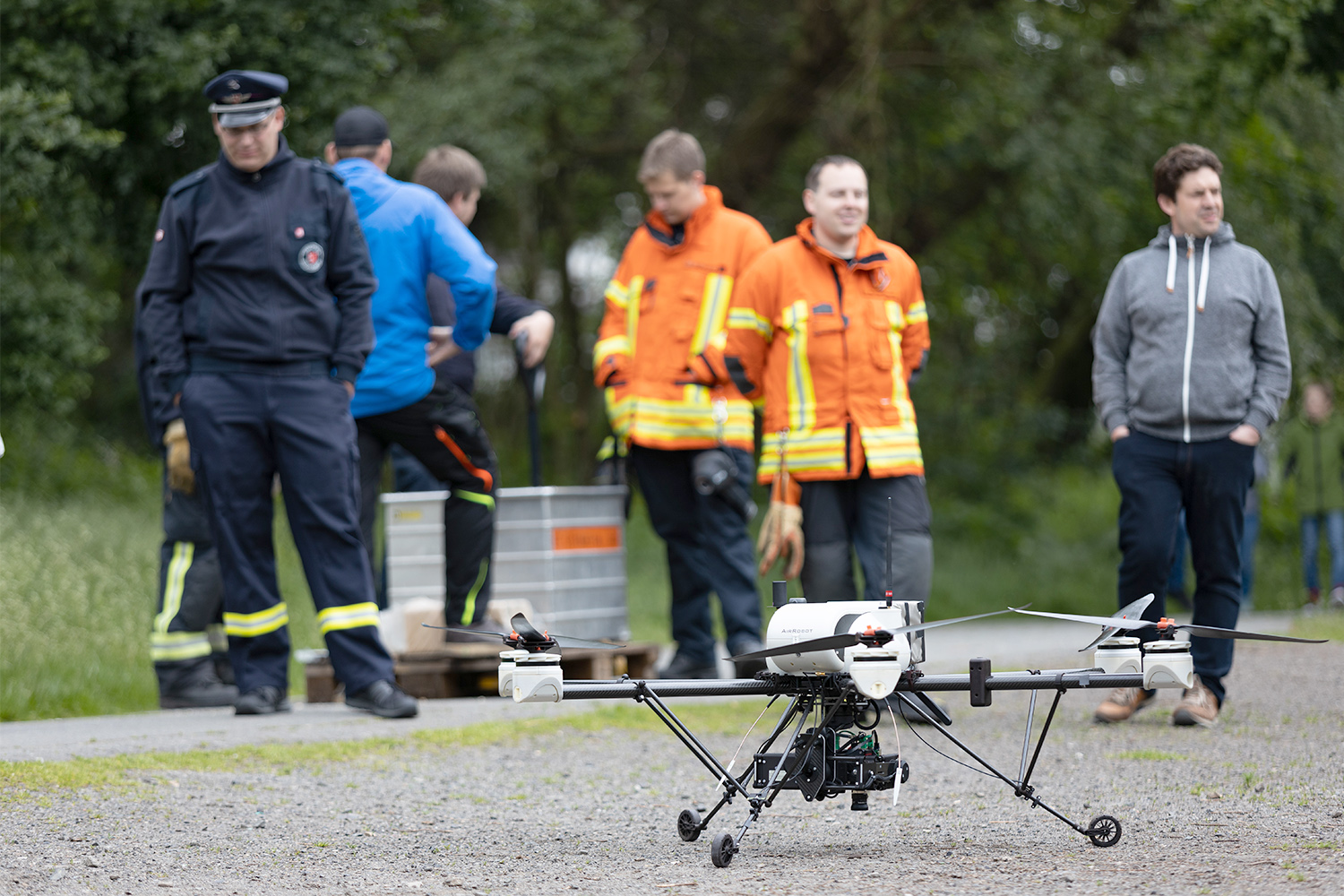
Test flight and data collection with the fire brigade Braunschweig. Picture credits: Jonas Vogel
In the “ANKommEn 2” project, researchers of the TU Braunschweig are developing flying and moving vehicles that are going to support rescue teams in the near future in the quick reconnaissance of an emergency area. Three institutes of the TU Braunschweig are involved in the research project: the Institute of Flight Guidance, the Institute of Mobile Machines and Commercial Vehicles and the Institute of Geodesy and Photogrammetry. Its main goal is the fully automatic generation of high-quality 2D and 3D maps (photo and 3D maps). With the help of these maps, rescue teams shall be able to quickly identify injured persons, glow nests, blocked ways or changes in structures such as dikes or dunes. The drone, developed together with the manufacturer Airrobot, is equipped with a colour and a thermal imaging camera. Alternatively, it can also be equipped with a 3D laser scanner.
-
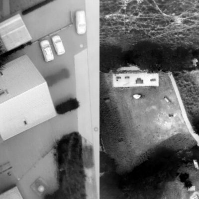
- Infrared air maps (excerpts). Picture credits: Markus Bobbe/TU Braunschweig
-
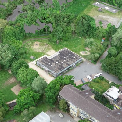
- 3D image generated by a drone. Picture credits: Markus Bobbe/TU Braunschweig
This is how the reconnaissance works
After the area of operation has been marked on the laptop of the emergency force, the drone automatically starts flying and sends high-resolution aerial photos of the area. The data can, for example, be sent to the ground station via an adaptive communication network that supports both the mobile network and a local WLAN. There, a map is generated during the flight using the algorithms developed. The exact maps are then made available to all emergency forces on their mobile tablets via a database running in the background. This way, all helpers receive quickly the best possible overview of the situation. Remote-controlled rovers equipped with a thermal imaging camera and a laser scanner can also be used to clear up unaccessible areas, for example in densely built-up areas, indoors or under dense vegetation.
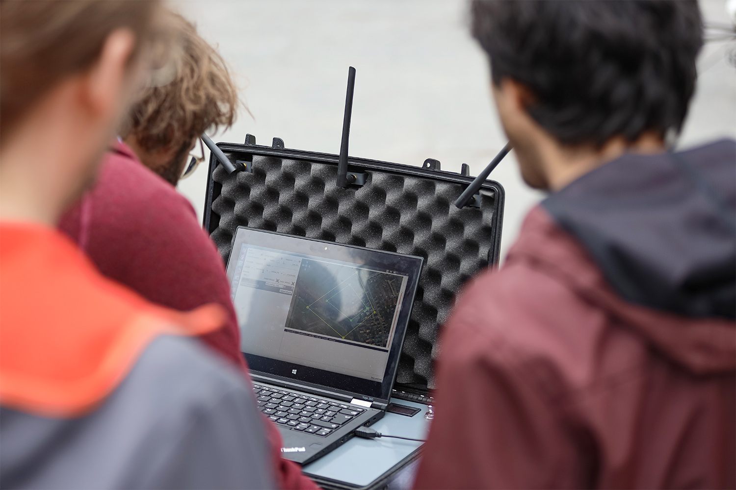
Data collection results are checked on the notebook. Picture credits: Jonas Vogel
Practice at the local fire brigade Stöckheim
The technology was successfully tested on the practice day in Stöckheim: A fire set up by the fire brigade and a person hidden in the bushes were quickly found. ” In the age of digitalisation, it is exciting to see that it does not stop at the fire brigade – and is also necessary here. “The research project makes it possible to quickly provide information to the heads of operations and emergency teams in the case of major damage situations, with which we can take quick action,” says Florian Parkitny of the local fire brigade Stöckheim.
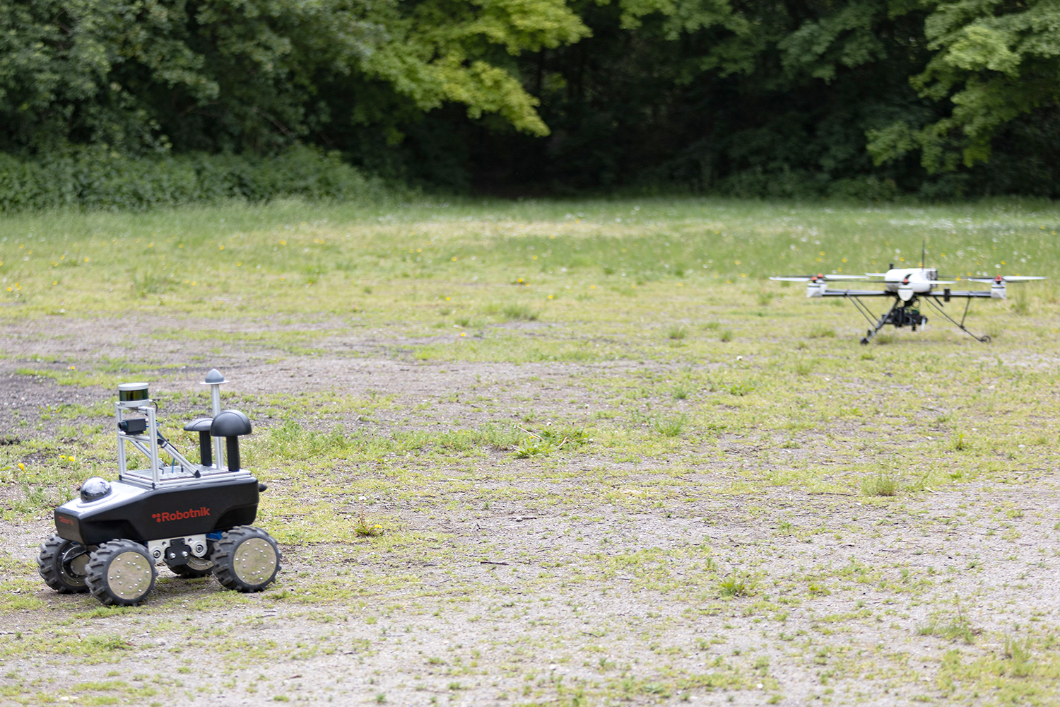
Drone and rover during a joint practice with the fire brigade Braunschweig. Picture credits: Jonas Vogel
By gaining an insight into the real operational procedures and feedback from the emergency forces, the researchers hope to be able to adapt the system even further to the special requirements of emergency operations. “We are glad that we were able to successfully test our technologies for real-time mapping and evaluation. The next step is to reduce the size of the hardware so that it can be used practically at any time,” says Markus Bobbe, a research assistant at the Institute of Flight Guidance of the TU Braunschweig.
The project ANKommEn 2 (February 2018 to July 2019) is supported by the Space Management of the German Aerospace Center with funds from the Federal Ministry of Economics and Energy on the basis of a resolution of the German Bundestag. The funding amounts to 612,000 euros.