Excursion with a view Logbook TransTiP - Part 3: On the way to the Hailuogou Glacier
Glaciers, dams and a breathtaking view! Before we go to Tibet, Dr. Nicole Börner, Kim J. Krahn and Alexandra Müller from the Institute for Geosystems and Bioindication make an excursion to the Gongga Mountains and the 2,000 year old Dujiangyan irrigation system. And the Braunschweig team of the international DFG Research Training Group TransTiP can breathe a sigh of relief: their entry permits have finally arrived.
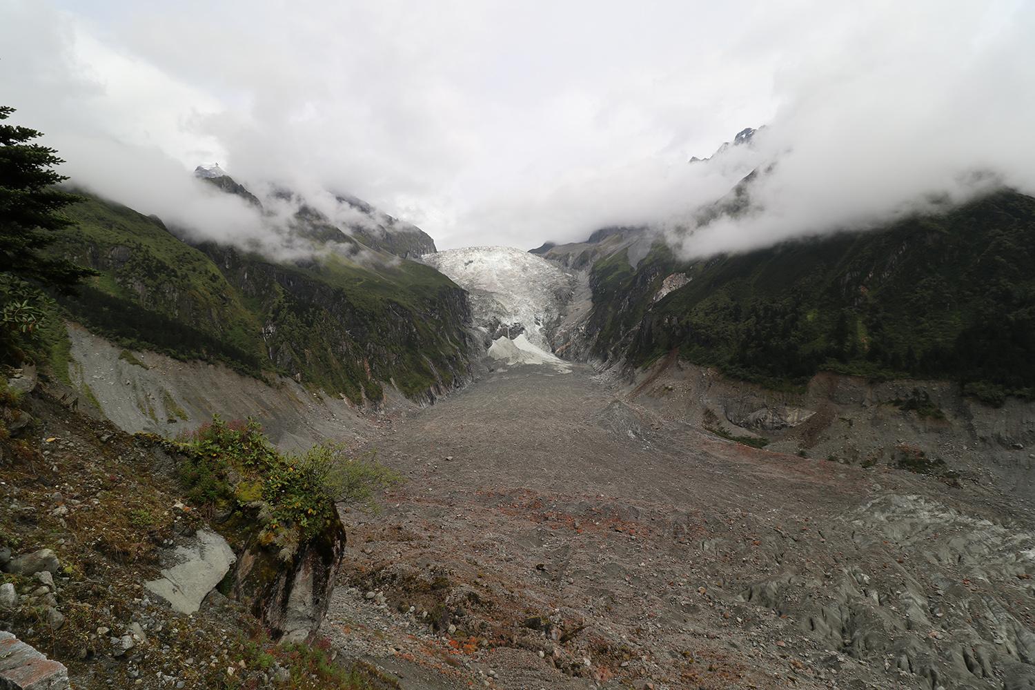
The Hailuogou Glacier in the Gongga Mountains belongs to the so-called “depris-covered glaciers”, which are characterised by a glacier
tongue covered with boulders. The thick layer of ice in the ground can only be guessed from the crevasses (lower left). Picture credits:
Kim J. Krahn/TU Braunschweig
“Last Monday we finally went on an excursion west to the Hailuogou Glacier in the Gongga Mountains. We stayed in Moxi, a small village with beautiful wooden facades in the midst of the mountains. The next day we took the cable car up to an altitude of 3,400 metres. When we reached the top, a breathtaking panorama presented itself. The sight of the glacier was impressive and sad at the same time, since global warming will lead to a significant melting in the next years. Prof. Tobias Bolch of St. Andrews University in Scotland explained clearly how this special form of the glacier develops, in which the entire glacier tongue is covered by boulders and is only recognizable as such at second glance. In the nearby observation station, the various meteorological measuring instruments for observing the glacier area were then presented.
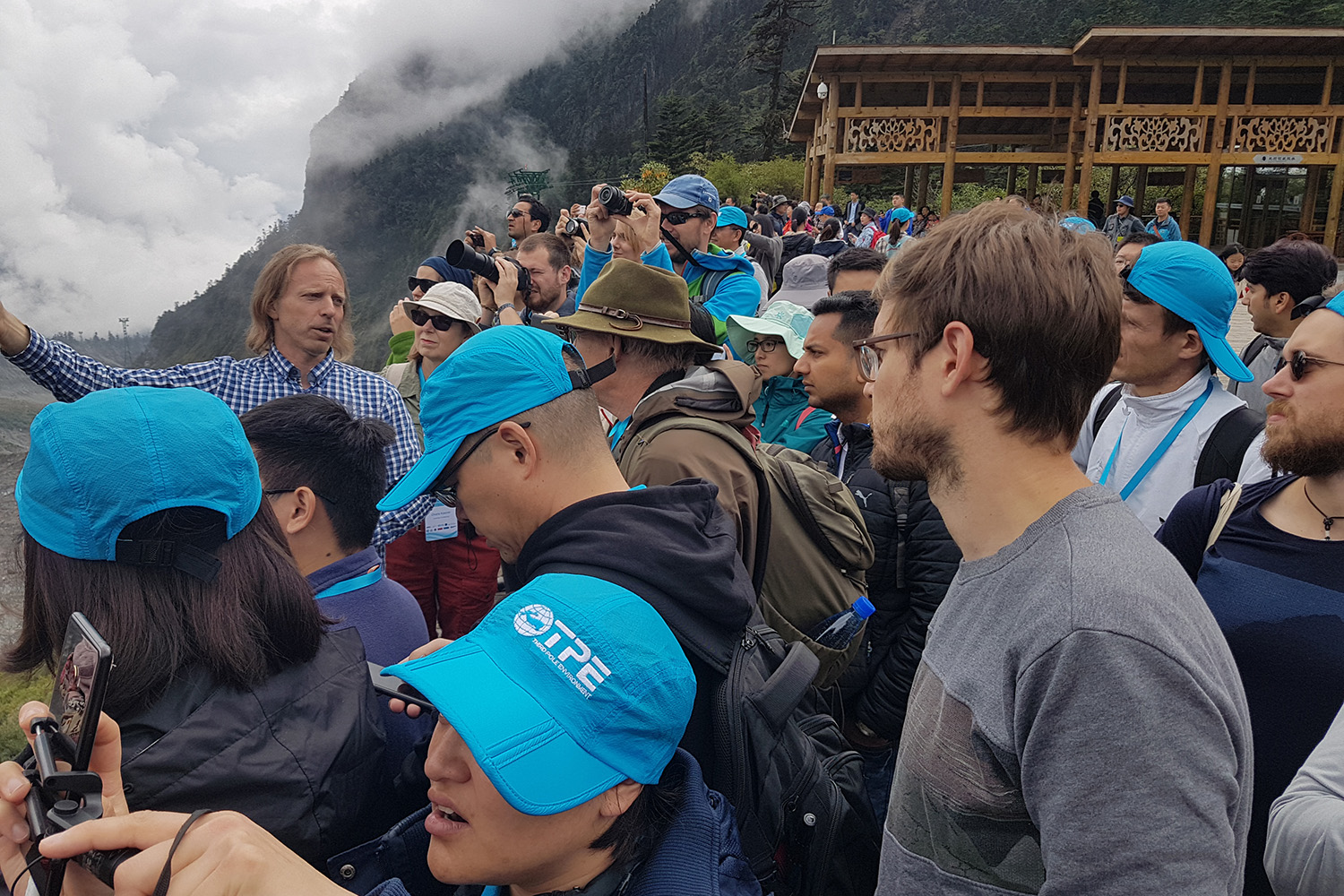
Prof. Tobias Bolch of St. Andrews University in Scotland explains the development of the glacier and the effects of climate change
directly on the glacier, which are shown in particular by the fact that the glacier tongue has almost completely separated from the glacier.
It will melt completely in the next few years, as it will no longer be “fed” by the glacier. Picture credits: Dr. Nicole Börner/TU
Braunschweig
The next stop on our excursion was Dujiangyan and its over 2000 years old irrigation system. It is especially remarkable that the flow rate of the Minjiang River could be regulated according to the rainy or dry season by various canal systems. In the past, the area was often threatened by uncontrolled flooding. With the development of the irrigation system, the water supply could be regulated and the agricultural areas in the Chengdu plain reliably supplied with water.
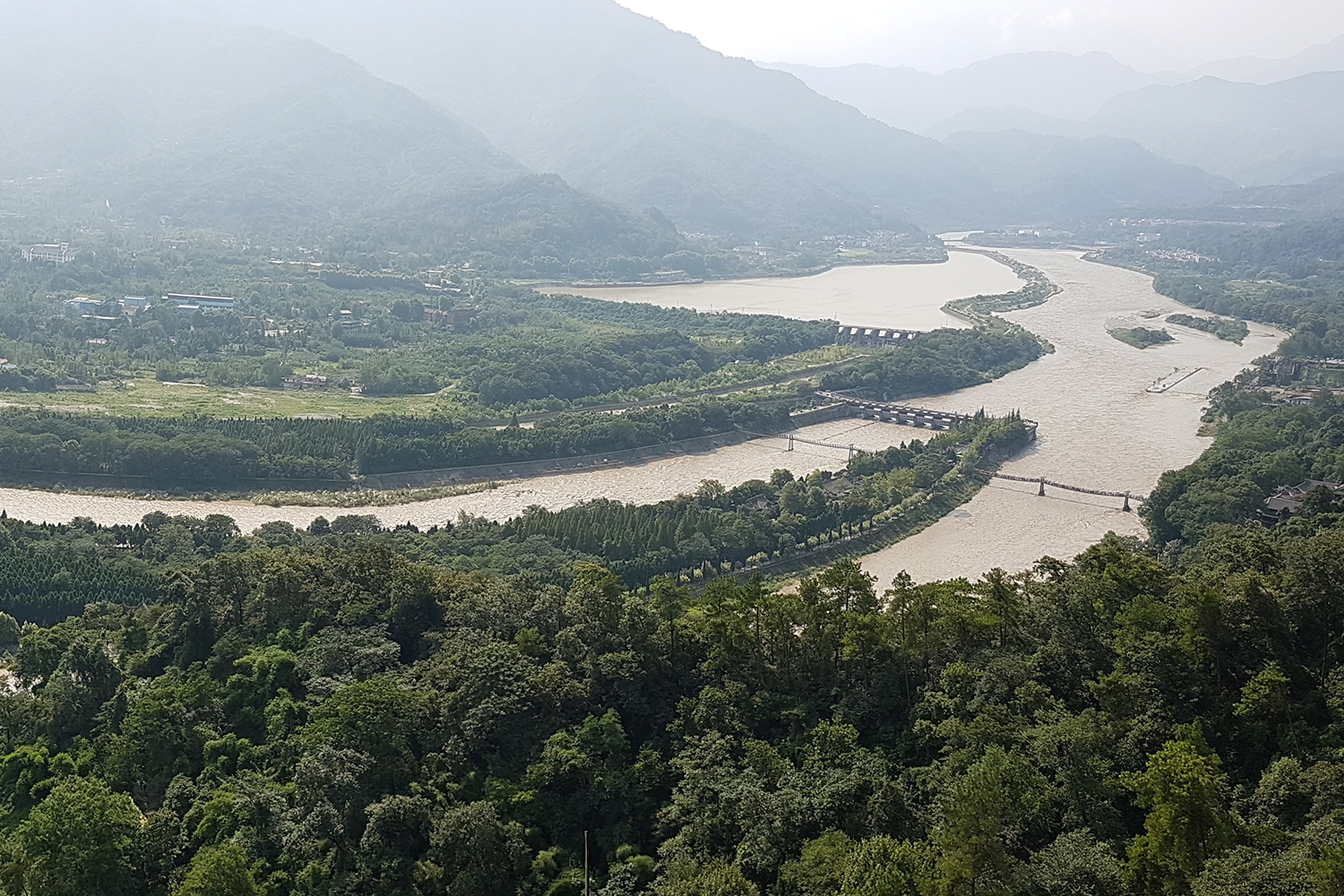
The irrigation system in Dujiangyan shows the impressive inventiveness of mankind as early as 256 BC. Through this technical
masterpiece, they controlled both floods and droughts, making the Chengdu plain one of the richest regions in China, the “land of
abundance”. Picture credits: Dr. Nicole Börner/TU Braunschweig
The permits are here – off to Tibet!
After long trembling we finally got our entry permits for Tibet one week before departure to Lhasa. The permission for this is issued at maximum ten days before the beginning of the trip, but often only a few hours before. Our equipment also made it through customs in Beijing and is now driven over land to the plateau. Now we have to keep our fingers crossed that everything arrives safe and without complications, so that we can start our field work.
Today our plane goes to Lhasa, where we will stay five days to visit the Institute of Tibetan Plateau Research (ITP), check the equipment and of course get used to the altitude, as Lhasa is 3,600 meters above sea level. In order to prevent the signs of altitude sickness, we have to drink a lot of water and slow everything down a bit.
Next week we will report back with a logbook entry for our first days in Tibet.”
Text: Dr. Nicole Börner, Kim J. Krahn, Alexandra Müller