Natural coastal defence against rising sea levels Researchers at TU Braunschweig investigate the effect of brushwood fences
The area in front of the dikes, with its salt marshes, plays a central role in coastal protection. Together with partners, scientists from Technische Universität Braunschweig are investigating the effectiveness and optimisation of these structures, which have been maintained for generations. The aim is to provide coastal protection authorities and planners with computer models that will enable them to better predict the effects of structural changes and sea-level rise on sediment deposition and thus on siltation.
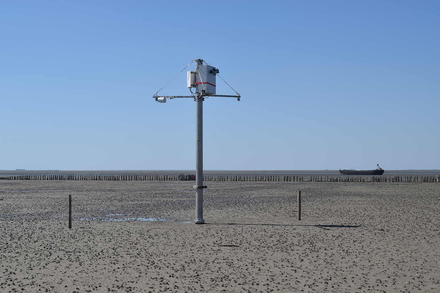
The measuring tower of the Leichtweiß Institute for Hydraulic Engineering and Water Resources in the brushwood groyne field measures the sea state and the direction of the waves. Picture credits: Felix Spröer/TU Braunschweig
Climate change is accelerating coastal erosion. In particular, ecosystems in the dike foreland, such as salt marshes, are under increasing threat. Salt marshes serve as a natural coastal defence, have a high level of biodiversity and habitat diversity, and also act as a carbon sink to store climate-relevant carbon. In the past, salt marshes have repeatedly shown that they can grow to a certain extent with rising sea levels. However, in some parts of the coast this is not happening fast enough. Groyne fields can be used here.
Groyne fields as ‘sediment traps’
Brushwood groyne fields are usually rectangular fields on the seaward side of the dike, consisting of a combination of wooden poles and brushwood packs called fascines. They act as a ‘sediment trap’ and increase the local deposition rate of sediment suspended in the water. Such fields were created centuries ago to transform sea into land over several decades. In the past, land reclamation shaped large parts of the North German coast.
Today, however, reclamation is no longer an objective in the Wadden Sea World Heritage Site. The groynes are now maintained solely as a natural element of coastal protection. “As a measure to adapt to rising sea levels, groynes offer the potential to further secure the salt marshes and thus reduce the load on the dikes,” says Felix Spröer, project member at the Leichtweiß Institute for Hydraulic Engineering and Water Resources at TU Braunschweig.
The construction and maintenance of groynes is mainly based on centuries-old knowledge and a few existing research reports. The scientifically supervised analysis of groynes therefore aims to better understand and improve the effectiveness of this coastal protection element.
Measuring campaign in the mudflats
Together with the Ludwig-Franzius-Institute for Hydraulic, Estuarine and Coastal Engineering (LUFI) of the Leibniz University of Hannover, the Schleswig-Holstein State Agency for Coastal Protection, National Parks and Marine Conservation (LKN.SH) and the Niedersachsen State Agency for Water Management, Coastal and Nature Conservation (NLWKN), scientists from TU Braunschweig have already carried out initial measurements on site.
While the LUFI took periodic measurements in a lapping field on the North Frisian island of Pellworm and on the coast near Hilgenrieders, the measuring tower permanently measures wave motion and direction without contact, is powered by a fuel cell for the sake of nature conservation, and delivers data in real time. “This is particularly important for the safe measurement of storm surges,” explains Felix Spröer. The researchers hope that the data collected will provide insights into the hydraulic-morphological interactions between groynes and dike forelands.
Experiments at the Leichtweiß Institute for Hydraulic Engineering and Water Resources
In addition to field measurements, experiments are carried out in the wave channels in Braunschweig and Hannover to study the detailed interaction of waves and currents with groynes and groyne fields. In nature, complex processes such as currents, waves, wind, local soil and sediment properties and human influences overlap, making it easier to analyse them in detail in the laboratory.
The scientists will then use the knowledge gained from field research and laboratory experiments to evaluate variations in the structure of the groyne fields in detailed computer models. These will map the interactions between groynes, currents and waves, sediment and local vegetation for different variants. In this way, the researchers hope to identify ways to improve the groyne fields, which can then be further tested in real-world laboratories. The research results can be a further element in nature-based, sustainable coastal protection to adapt to climate change.
Project data
The VeMoLahn research project is funded by the German Federal Ministry of Education and Research (BMBF) from November 2022 to October 2025 with around 315,700 euros (funding code: 03F0929A). “VeMoLahn” stands for the interaction of vegetation and morphodynamics in groynes. In addition to the Department of Hydromechanics, Coastal Engineering and Ocean Engineering at the Leichtweiß Institute for Hydraulic Engineering and Water Resources, the Ludwig Franzius Institute for Hydraulic Engineering and Estuarine and Coastal Engineering at the Leibniz University of Hannover, the State Office for Coastal Protection, National Park and Marine Conservation of Schleswig-Holstein and the State Office for Water Management, Coastal and Nature Conservation of Niedersachsen are also involved.
Further information: www.tu-braunschweig.de/lwi/hyku/forschung/projekte/vemolahn