Fish become master builders Research project "MigRamp" at TU Braunschweig investigates preferred swimming paths
Fish migrate. Not only salmon, but also grayling, bullhead and perch change their location again and again in search of food, a place to spawn or to overwinter, for example. But which paths do fish prefer on rock ramps, i.e. near-natural structures in streams and rivers, when they migrate upstream? This is what the Department of Hydraulic Engineering and River Morphology of the Leichtweiß Institute for Hydraulic Engineering and Water Resources (LWI) at Technische Universität Braunschweig is investigating in the “MigRamp” project.

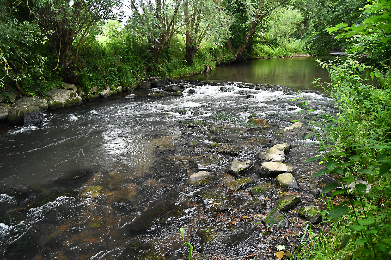
Near-natural unstructured rock ramp in the Ilme near Einbeck. Photo credits: Ralph Eikenberg/TU Braunschweig
Natural rock ramps are structures in flowing waters that serve water management purposes, such as ensuring a minimum water level or preventing erosion. For fish and small organisms, they normally do not represent an obstacle to migration. Especially so-called unstructured rock ramps have a heterogeneous stream bed with diverse flow conditions due to the irregular arrangement of large rocks. They also provide additional habitat. The design of such structures has so far been based on laboratory tests, as natural measurements are very time-consuming and corresponding data are hardly available. As a result, unstructured rock ramps are often not built despite their advantages.
Important natural datasets
This is where the “MigRamp” project comes in. In laboratory and field tests, the scientists want to identify the preferred migration corridors of the fish. To do this, the swimming paths are linked to the structural geometry of the rock ramps and the flow conditions along the paths. “So, casually speaking, the fish are being made their own master builders,” says Ralph Eikenberg, research assistant in the LWI’s Department of Hydraulic Engineering and River Morphology, who is in charge of the project. The aim is to improve the understanding of upstream fish migration and thus improve the design criteria for rock ramps in rivers and streams that are relevant for engineering practice.
The target group of the results are practising engineers, authorities, planners and maintenance associations who deal with the dimensioning of rock ramps. “The data are also of great interest to the scientific community, as there are very few or almost no natural data sets on the fish-current-geometry interaction for the optimisation of fish-passable structures,” says project leader Professor Jochen Aberle.
1:1 model of the rock ramp in the “Laxelerator”
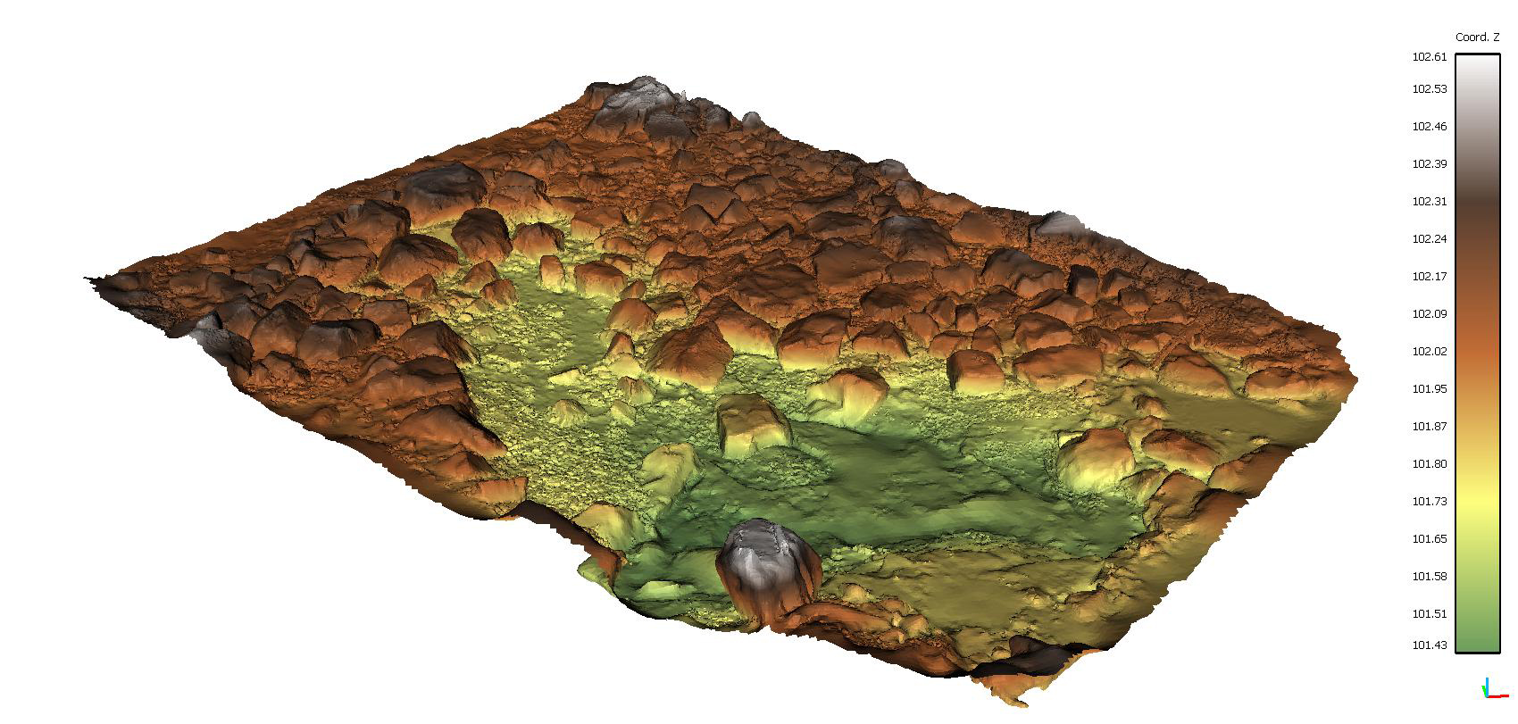
For the project, the project team selected a rock ramp on the Ilme near Einbeck in southern Lower Saxony. The structure was drained briefly in autumn 2020 in a one-off operation with the support of the Leineverband, which is one of the project partners, and the German Federal Agency for Technical Relief (THW). “The fish were of course salvaged and brought to safety beforehand,” emphasises Ralph Eikenberg. This allowed the scientists to measure the ramp in detail. Laser scanning and structure-from-motion photogrammetry, in which a three-dimensional point cloud is generated from many individual photographs of the object, provided a digital elevation model as the basis for the laboratory model.

Digital elevation model as a result of surveying the ramps in the field. Image credits: Ralph Eikenberg/TU Braunschweig
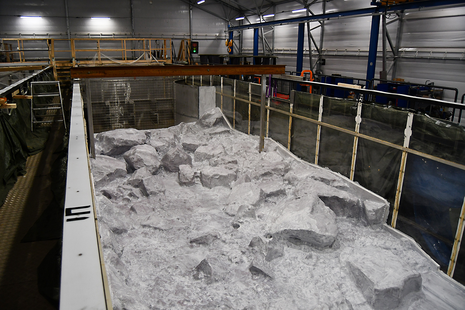
From Lower Saxony, the journey then continued to central Sweden: In the hydraulic engineering laboratory of the project partner Vattenfall Research & Development in Älvkarleby, the rock ramp was recreated as a 1:1 model in the “Laxelerator”. This experimental channel, the only one of its kind in the world, is specially designed for large-scale experiments with fish and resembles a racetrack with two parallel sections, each 24 metres long and four metres wide, connected by two 180-degree bends. The four-metre-wide and twelve-metre-long partial model of the rock ramp was made from polystyrene using CNC milling technology and could be put into operation in September 2021. Vattenfall designed the model so that it could be used several times. After the tests were completed, it was dismantled and is now waiting for its next use for similar questions.

View of the model in the “Laxelerator” before the start of the laboratory experiments. Photo credits: Ralph Eikenberg/TU Braunschweig
Where do the fish move?
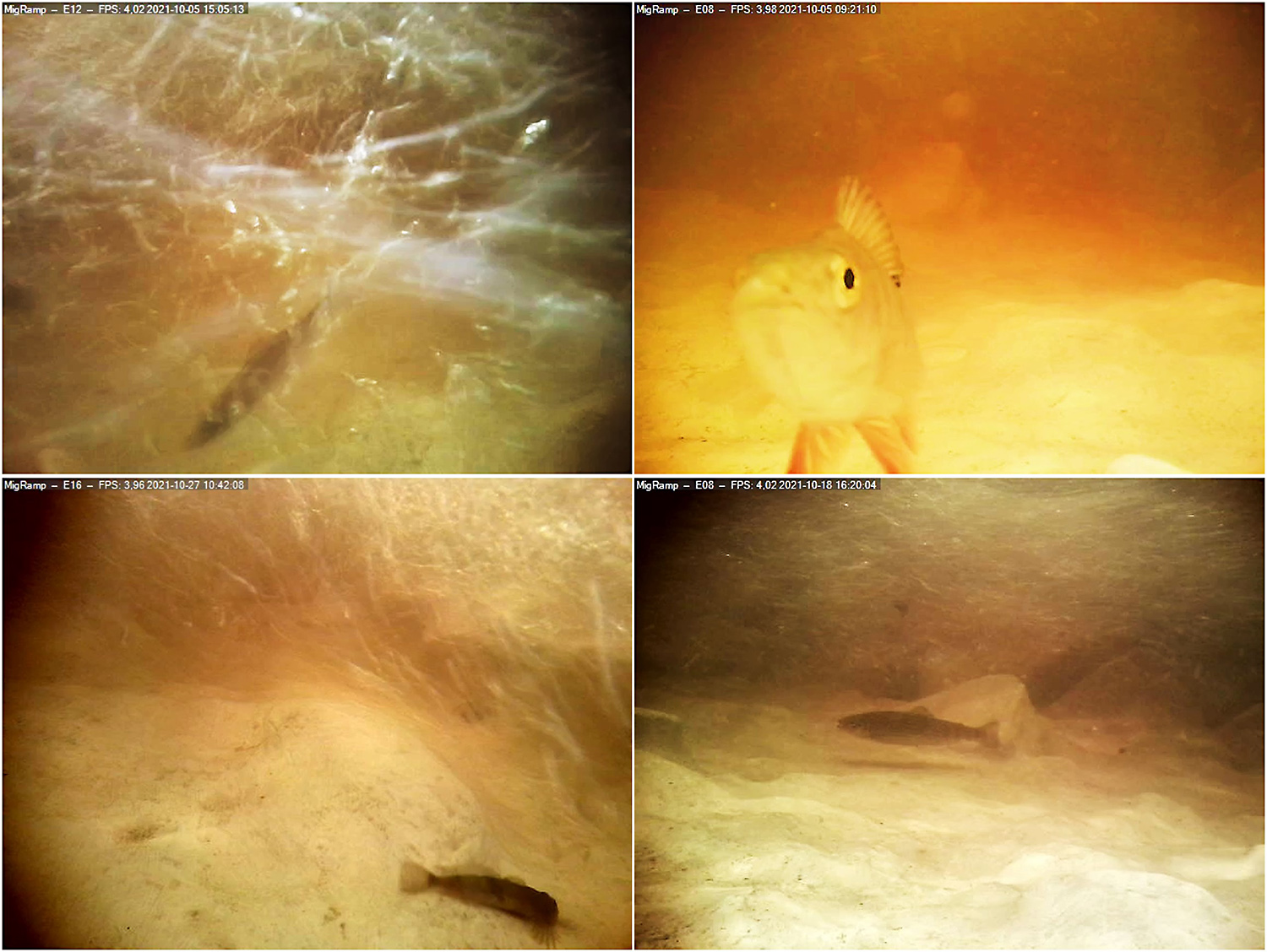
In order to observe the movements of the fish in detail, the scientists equipped the model with more than 30 individual cameras above and below the water. They used trout (Salmo trutta), grayling (Thymallus thymallus), bullhead (Cottus gobio) and perch (Perca fluviatilis) – at various natural flows of up to 1,200 litres per second and in different combinations of fish species, numbers and sizes.
The trials were approved in advance by the Swedish Board of Agriculture. A fish biologist also assisted with the research. The fish came from breeding programmes (trout and grayling) as well as from wild catches (bullheads and river perch) and were released safely into the wild after the trials.

Underwater camera images from the ethohydraulic experiments (top left: grayling, top right: perch, bottom left: bullhead, bottom right: trout). Photo credits: Ralph Eikenberg/TU Braunschweig
The researchers then carried out hydraulic measurements in the partial model of the bed channel in order to later be able to describe the flow conditions along the movement paths of the fish.
The scientists want to use the swimming paths determined in the “Laxelerator” to also equip the Ilme rock ramp with cameras above and below water at suitable positions from mid/end April 2022 and observe the wild fish during passage. The flow field above the real ramp will be recorded under natural conditions using the same methods as in the laboratory.
Project data
The “MigRamp” project is funded by the German Federal Foundation for the Environment with 216,876 euros until November 2022. The name of the project is a combination of “migration” and “ramp”. In addition to the Leichtweiß Institute for Hydraulic Engineering and Water Resources at TU Braunschweig, the Leineverband and Vattenfall Research & Development AB from Sweden are also involved.
