Measuring campaign on ice TU Braunschweig and TU Wien test geophysical measuring methods in the Austrian Alps
They braved wind and weather: four members of staff from the Institute of Geophysics and Extraterrestrial Physics (IGEP) at TU Braunschweig spent a week working on a glacier in the Austrian Alps. There they investigated its internal structure and the composition of the rock under the ice. In collaboration with TU Wien, they used various measuring methods to compare them in the icy environment.
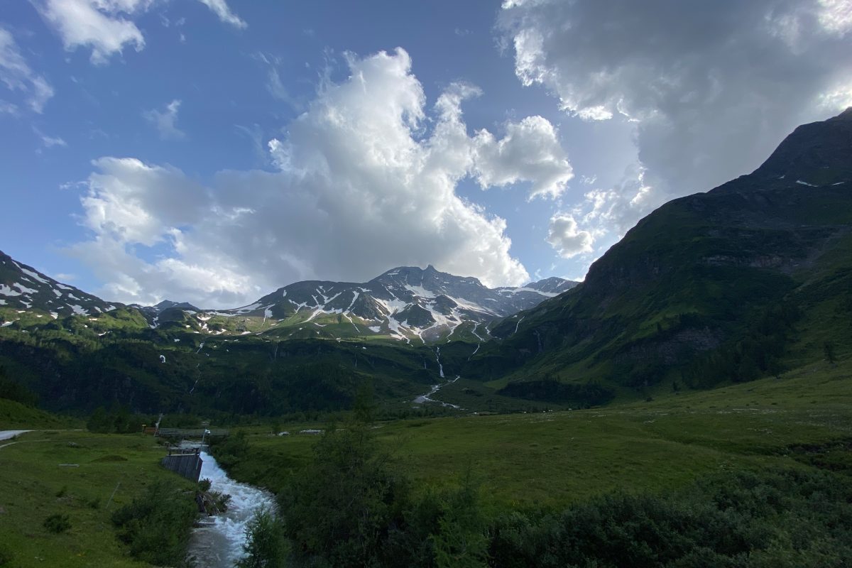
The Hohe Sonnblick seen from the valley on the day of arrival. The weather is still good. Photo credit: Lukas Aigner/TU Wien
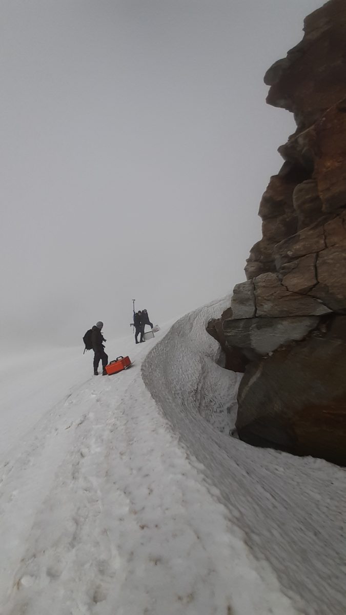
The daily transport of the heavy and bulky measuring instruments through rough terrain. The Goldbergkees glacier can be seen in the background. Photo credit: Robin Zywczok/TU Braunschweig
Arrival on the glacier, which is still covered by a layer of snow more than three metres high at the time of the measurements. Photo credit: Matthias Bücker/TU Braunschweig
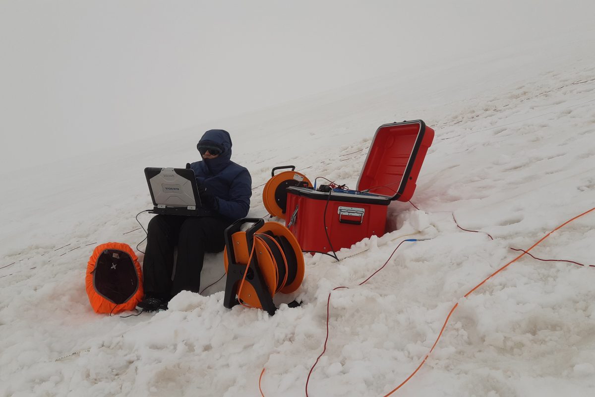
Madhuri Sugand during measurements on the glacier. The red box belongs to the measuring device used to measure the high-frequency induced polarisation. Photo credit: Matthias Bücker/TU Braunschweig
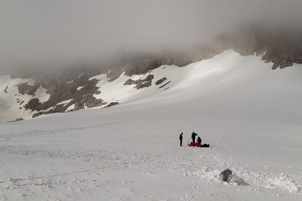
One of the rare moments during the measuring campaign when the otherwise always dense fog breaks up and reveals a view of the glacier. Photo credit: Matthias Bücker/TU Braunschweig
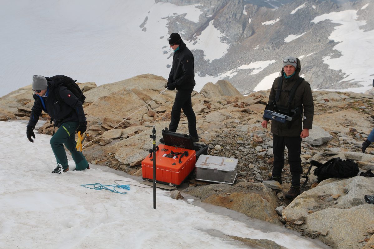
Lukas Aigner, Johannes Hoppenbrock and Robin Zywczok (from right) prepare a georadar measurement. The red box in the centre of the picture houses the radar antenna. Photo credit: Matthias Bücker/TU Braunschweig
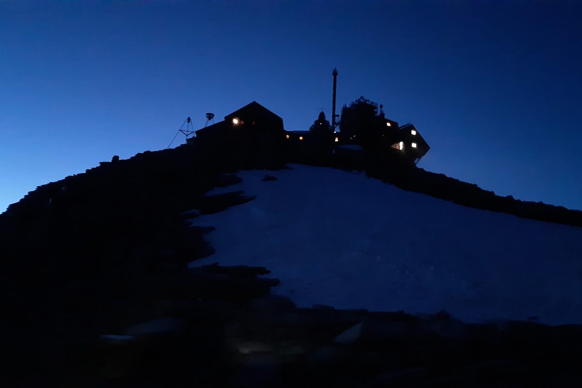
The Zittelhaus (left) and the observatory on the summit of Hoher Sonnblick shortly after sunset. Photo credit: Matthias Bücker/TU Braunschweig
Glaciers are ancient ice giants that have retreated to the highest Alpine peaks in Central Europe. To learn more about their millennia-long history of formation and their nature, scientists use different methods, each of which has its own characteristics and provides different insights. Among them are ground penetrating radar, transient electromagnetics and high frequency spectral induced polarisation. To compare these methods, Johannes Hoppenbrock, Madhuri Sugand, Matthias Bücker and Robin Zywczok from the IGEP went to the 3,106-metre summit of Hohen Sonnblick in Salzburger Land, Austria.
Big boxes, small cableway
There, they and their bulky equipment, impassable terrain, steep slopes and the glacier just below the summit awaited them. Not an easy combination: “The logistics during the campaign were quite a challenge,” Matthias Bücker reports. “A cableway is available to transport the equipment from the valley to the summit, but we had to manage the daily transport of the heavy equipment between the observatory on the summit and the measurement area on the lower-lying Goldbergkees glacier with muscle power alone.”
Although neither skiers nor ski lifts disturbed the measurements on the remote glacier, the weather conditions did. “At the beginning of the campaign, we didn’t always believe we could complete all the measurements in time. The weather went crazy! From squalls and thunderstorms to hail and snow to heavy fog with visibility below 20 metres; everything was there,” Madhuri Sugand recalls. Fortunately, after the first two or three days, the weather calmed down a bit.
Measuring methods in comparison
Each day, the team focused on a different measuring method. They started with ground penetrating radar, which uses high-frequency electromagnetic waves that are reflected at material boundaries in the subsurface. Above all, the thickness of ice layers can be determined well with this, but conclusions about the composition of the ice are also possible. “Fortunately, the work with the ground penetrating radar was quite simple and fast. And the processing of the data also went so quickly that we were able to select suitable areas for the next method, high-frequency induced polarisation, based on these initial results,” explains Bücker.
High-frequency induced polarisation is a new method being developed in the working group of Professor Andreas Hördt, also from IGEP. Along measurement lines, the researchers press steel skewers into the snow covering the glacier to make contact with the ground. The cables of the measuring device are then connected to these skewers. Between every two skewers, electricity is injected into the ground and another two skewers are used to measure a voltage. In this way, the electrical conductivity of the subsoil is determined, which in turn contains information about the nature of the subsoil, such as the ice content.
Lukas Aigner, a colleague from TU Wien, resorted to a third measuring method, transient electromagnetics. Here, magnetic fields are built up and dissipated by means of large coils, which thereby also transmit currents into the subsurface. Matthias Bücker explains: “This method has rarely been used on glaciers so far, which is why it was first necessary to find out the basic limitations and possibilities.”
After the measuring campaign is before the measuring campaign
“The first thing we have to do now is evaluate the data. That will take some time, but our first impressions are promising,” says Bücker. “We would then like to return to Sonnblick in October. This campaign was part of the EU-funded INTERACT programme, which primarily provides access to observatories in the Arctic but also in the European high mountains. In October, when the snow cover on Sonnblick has thawed further, we would like to carry out a second campaign in which we will focus more on the permafrost in the solid rock that also exists around the summit,” says Bücker.
“As part of my doctorate, I will also apply the method of high-frequency induced polarisation in other environments,” says Sugand. “The next campaign will start in mid-August in the Italian Alps. My personal goal is, on the one hand, to find out what information we can derive from this technique. On the other hand, I also want to understand how permafrost changes over time and how this change affects the water balance of cold regions.” Sugand, a doctoral student in the TransTiP research training group, actually had a field campaign in Tibet scheduled for this summer, but it had to be cancelled due to the current tense pandemic situation.
The measurements on the Hohe Sonnblick serve to further develop measuring and evaluation methods that could also be used in comprehensive research into climate change and its consequences – especially in relation to the cold regions of the Earth. However, the methods and their interaction must first prove themselves. The researchers agree that the logistical challenges and the demanding weather conditions are worth it.